
Thursday, 2 August 2012

All OSGeo-Live java applications now working with OpenJDK 7

100% of OSGeo-Live java applications are now running successfully using OpenJDK 7 in OSGeo-Live 6.0 beta releases.
This move to OpenJDK has been driven by Oracle's announcement that the "Operating System Distributor License for Sun Java has been retired", meaning that Sun Java is no longer allowed to be distributed in Linux distributions such as Ubuntu, or OSGeo-Live.
The good news is that OpenJDK, the fully Open Source implementation of java, has improved to the point where we have shown that all OSGeo-Live applications will run under OpenJDK 7. And by extension, we have shown it is feasible to incorporate these applications in linux distributions.
We have verified applications compile and quickstarts run as expected, and we have been impressed with what we have seen. However we have not done comprehensive testing of all functionality in each application. Nor have we tested performance or reliability. Users who wish to see a specific application deployed into production using OpenJDK should contact the project about whether more detailed testing has been completed.

About OSGeo-Live

OSGeo-Live is an XUbuntu based distribution of Geospatial Open Source Software, available via a Live DVD, Virtual Machine and USB. You can use OSGeo-Live to try a wide variety of open source geospatial software without installing anything.
Image Source:  http://spagettikoodi.files.wordpress.com/2010/11/java-duke-guitar.png

Wednesday, 18 July 2012

Australian National Environmental Information Infrastructure pilot

 LISAsoft has recently supported the Australian Bureau of Meteorology set up a National Environmental Information Infrastructure pilot.
The natural environment plays an important role in Australia’s economy and way of life. To manage it effectively, governments, industry and the community need comprehensive, trusted and timely environmental information to make sound environmental decisions. To support this need, the Australian Bureau of Meteorology (the Bureau) is leading the National Plan for Environmental Information initiative that will deliver improved quality, coverage, usability and access to environmental information. As one element of the initiative LISAsoft has supported the Bureau in piloting parts of a National Environmental Information Infrastructure (NEII).  This pilot has demonstrated the process of modelling and publication of environmental information from atmosphere, ocean, land and water domains.

There are multiple challenges involved in achieving an effective infrastructure. First, the source data, which is continuously updated by multiple agencies, needs to be dynamically collated into aggregated datasets to facilitate macro analysis. This requires development and agreement upon standard data formats, processes and tools which source agencies can use to publish the source data. Once aggregated, the data requires distribution and publishing in a manner that can easily be accessed and manipulated by end users. This requires a robust and reliable publishing infrastructure, built upon standard interfaces, which can be used easily and efficiently by existing or provided tools. Furthermore, the infrastructure developed needs to be both feasible and sustainable. As such, the Bureau has selected a distributed design, based upon OGC standards based services and formats.
This early NEII pilot has focused on the development of standard information models, and a reference implementation of a source data node. LISAsoft has helped the Bureau by:
  • Consulting on and documenting the NEII architecture design.
  • Defining some of the information models required.
  • Developing pilot implementations of an NEII node. The NEII node publishes data via a Web Feature Service (WFS) interface using the GeoServer spatial data server.  GeoServer has been the target of recent CSIRO development efforts to create a service capable of supporting the complexity of data models required for projects such as NEII.
  • Configuring a web based catalogue which can be used to find datasets. This is based upon the Catalogue Service for the Web (CSW) interface, and implemented using the Open Source GeoNetwork application.
  • Testing of the conformance of the services within the pilot.
To support the Bureau, LISAsoft has drawn upon years of relevant experience, including:
  • Domain Modelling during international, OGC standards development testbeds
  • Co-authoring a Domain Modelling Cookbook with CSIRO
  • Testing conformance of Web Feature Services in both Australian Spatial Data Infrastructures as well as in OGC testbeds.
  • Deploying, configuring and optimising GeoServer for multiple projects.
The NEII pilot has completed successfully and has validated the feasibility of the proposed design, and provided valuable feedback into the practicality of the approach and tools. These valuable lessons will be fed into the greater National Plan for Environmental Information initiative.

Thursday, 21 June 2012

Calling for "OSGeo Advocate" profiles

Do you know a lot about aspects of Geospatial Open Source, and are prepared to stand up in public and talk about it? Then please consider adding your name to the "OSGeo Advocate" list.

Background:

With my role on the marketing committee, increased number of foss4g related conferences, and with the success of the OSGeo-Live DVD, I'm now regularly being asked to recommend speakers who can talk about OSGeo related topics. Arnulf, as chair of OSGeo, similarly reports being invited to present at more conferences than he can sustain. So the OSGeo Marketing committee has created a space to show off the breadth of experience amongst our OSGeo community, which at the same time will allow conference organisors find local OSGeo experts.
Is this something you can help with? If so, please register within the next month, before the end of July 2012, when we intend to officially launch.

Monday, 30 April 2012

Call for interest in OSGeo-Live 6.0

We are starting to build the 6.0 OSGeo-Live DVD which will be released in September 2012, ready for FOSS4G 2012 as well as many other spatial conferences. This upcoming version will be built upon the stable Xubuntu 12.04 Long Term Support (LTS) release. Documentation will be translated into eight languages, now also including Chinese and Catalan.
Any new applications?
We would like to hear from anyone wishing to add new projects to OSGeo-Live, anyone wishing to extend or add extra translations, or anyone who has ideas on how we should shape the upcoming release.

Key Priorities for next release

Package Updates
Migrate to Xubuntu 12.04 LTS
Update and test latest stable software releases
Migrating to OpenJDK
Due to Oracles changed license conditions for Sun-Java, Ubuntu users are now strongly encouraging to move to OpenJDK instead of Sun Java, due to both improvements in OpenJDK, and difficult licencing conditions with Sun Java. As such, we will be endevouring to move all java based applications to OpenJDK (instead of Sun Java).
Disk Space
We have reached our DVD size limits, and need to be creative about saving space and disciplined in not losing space to duplication. We hope to ship a single Java and single Tomcat version this time, in addition to further consolidation around shared sample datasets.
Testing
With Quality being a key focus area for us, we need lots of help with testing.

Key Milestones

10 Jul 2012 Feature Freeze
07 Aug 2012 User Acceptance Test (all Apps installed and working)
28 Aug 2012 Final ISO sent to printers
... full schedule

About OSGeo-Live

OSGeo-live is an XUbuntu based distribution of Geospatial Open Source Software, available via a Live DVD, Virtual Machine and USB. You can use OSGeo-Live to try a wide variety of open source geospatial software without installing anything.

Saturday, 17 March 2012

LISAsoft's training for Geospatail Open Source

If you work for one of the many Australian organisations which are starting to make use of geospatial open source, and you'd like to get skilled up in the technologies, then you will probably want to ask your boss to send you to one of LISAsoft's training courses.
LISAsoft has the following courses scheduled to be run this financial year:

Friday, 2 March 2012

Highlights from GeoNext Conference, Sydney, Australia

The recent GeoNext conference in Australia provided an interesting and very refreshing set of diverse presentations, covering the emerging technologies and businesses which are making use of geospatial.
I answered interview questions around how to successfully build a business around Open Source, with a focus on Geospatial.
James Moody, a futurist from CSIRO, boldly predicted that the next wave of innovation will address moving from a world of abundance to a world of scarcity, and the next big business opportunities will be based around improving efficiencies and recycling waste.
It was disappointing to discover that the Australian http://data.gov.au initiative, which was looking very promising a year ago, doesn't have anyone driving it anymore.
There were talks on augmented reality, cartography, geocaching, mobile gaming, building and marketing mobile applications, and some great lessons on building a startup company as 3 startups made a pitch to judges.
Further on the business front, I was very impressed with a presentation from Mark Carniello. It is challenging for Australian companies to break into the US market, largely because a personal sales call to the US costs $10K worth of travel costs - and yet Mark explained how his Australian manned company is successfully selling a mission-critical system to electrical utilities in North America by setting up a virtual office, and leveraging phones and internet technology.
This is certainly an event to look out for again next year.

Wednesday, 29 February 2012

OSGeo-Live 5.5 ready to distribute at international conferences

Version 5.5 of the OSGeo-Live GIS software collection and accompanying Lightening Presentation, has been released, ready for distribution at a large number of geospatial conferences and workshops from around the world.

About OSGeo-Live
OSGeo-Live is a self-contained bootable DVD, USB flash drive and Virtual Machine based upon Ubuntu Linux that is pre-configured with a wide variety of robust open source geospatial software. The applications can be trialled without installing anything on your computer, simply by booting the computer from the DVD or USB drive. The lightening overview introduces all these applications, and hence provides a comprehensive introduction to the breadth of Geospatial Open Source.

Highlights
  • 50 Quality Geospatial Open Source applications installed and pre-configured
  • Quality free world maps and geodata
  • One page overviews and quick start guides for all applications
  • Overviews of key OGC standards
  • Translations for Greek, German, Polish, Spanish and Japanese
Contents

Browser Clients
  • OpenLayers - Browser GIS Client
  • Geomajas - Browser GIS Client
  • Mapbender - Geoportal Framework
  • MapFish - Web Mapping Framework
  • GeoMoose - Web GIS Portal
Crisis Management
  • Sahana Eden - Disaster management
  • Ushahidi - Mapping and Timeline for events
Databases
  • PostGIS - Spatial Database
  • SpatiaLite - Lightweight Database
  • Rasdaman - Multi-Dimensional Raster Database
  • pgRouting - Routing for PostGIS
Desktop GIS
  • Quantum GIS (QGIS)
  • GRASS GIS
  • gvSIG Desktop
  • User-friendly Desktop Internet GIS (uDig)
  • Kosmo Desktop
  • OpenJUMP GIS
  • SAGA
  • OSSIM - Image Processing
  • Geopublisher - Catalogue
  • AtlasStyler - Style Editor
  • osgEarth - 3D Terrain Rendering
  • MB-System - Sea Floor Mapping
Navigation and Maps
  • GpsDrive - GPS Navigation
  • Marble - Spinning Globe
  • OpenCPN - Marine GPS Chartplotter
  • OpenStreetMap - OpenStreetMap Tools
  • Prune - View, Edit and Convert GPS Tracks
  • Viking - GPS Data Analysis and Viewer
  • zyGrib - Weather Forecast Maps
Spatial Tools
  • GeoKettle - ETL (Extract, Transform and Load) Tool
  • GDAL/OGR - Geospatial Data Translation Tools
  • GMT - Cartographic Rendering
  • Mapnik - Cartographic Rendering
  • MapTiler - Create Map Tiles
  • OTB - Image Processing
  • R Spatial Task View - Statistical Programming
Web Services
  • GeoServer
  • MapServer
  • deegree
  • GeoNetwork - Metadata Catalogue
  • pycsw - Metadata Catalogue
  • MapProxy - Proxy WMS & tile services
  • QGIS Server - Web Map Service
  • 52°North WSS - Web Security Service
  • 52°North WPS - Web Processing Service
  • 52°North SOS - Sensor Observation Service
  • TinyOWS - WFS-T Service
  • ZOO Project - Web Processing Service
Data
  • Natural Earth - Geographic Data Sets
  • OSGeo North Carolina, USA Educational dataset
  • OpenStreetMap - Sample extract from OpenStreetMap
Geospatial Libraries
  • GeoTools - Java GIS Toolkit
  • MetaCRS - Coordinate Reference System Transformations
  • libLAS - LiDAR Data Access
Other software of interest (not available Live)
  • MapWindow GIS - Microsoft Windows based GIS
  • MapGuide Open Source - Web Service
Where to find OSGeo-Live

You can pick up an OSGeo-Live DVD or USB and/or see the presentation at:
  1. Our http://live.osgeo.org website
  2. Malaysian Geospatial Forum, Malaka, Malaysia, March 2012
  3. Spanish FOSS4G 2012, Girona, Spain, March 2012
  4. FOSSGIS 2012, Dessau, Germany,March 2012
  5. AWRA GIS and Water Resources Conference, New Orleans, USA, March 2012
  6. GISRUK 2012, Lancaster University, UK, April 2012
  7. FOSS4G North America 2012, Washington DC, USA, April 2012
  8. FOSS4G-CEE & Geoinformatics 2012, Prague, Czech Republic, May 2012,
  9. MapWindow/FOSS4G Regional Netherlands, Velp, The Netherlands, June 2012
  10. International Environmental Modeling and Software Society Conference (IEMSS), Leipzig, Germany, July 2012
  11. 34th International Geological Conference, Brisbane, Australia, August 2012
  12. International FOSS4G2012, Beijing, China, September 2012
  13. INTERGEO, Hannover Germany, October 2012
Credits
Over 80 people have directly helped with OSGeo-Live packaging, documenting and translating, and thousands have been involved in building the packaged software.
Packagers, documenters and translators include: Agustín Díez, Aikaterini Kapsampeli, Alan Boudreault, Alexandre Dube, Alex Mandel, Andrea Antonello, Andrea Yanza, Angelos Tzotsos, Anne Ghisla, Anton Patrushev, Argyros Argyridis, Astrid Emde, Brian Hamlin, Bruno Binet, Cameron Shorter, Christos Iossifidis, Dane Springmeyer, Daniel Kastl, David Mateos, Diego González, Dimitar Misev, Dominik Helle, Edgar Soldin, Eike Hinderk Jürrens, Eric Lemoine, Etienne Dube, Fran Boon, François Prunayre, Frank Gasdorf, Gavin Treadgold, Gérald Fenoy, Hamish Bowman, Haruyuki Seki, Henry Addo, Hernan Olivera, Howard Butler, Ian Turton, Jackie Ng, Jan Drewnak, Javier Sanchez, Jesús Gómez, Jim Klassen, Jody Garnett, Johan Van de Wauw, Jorge Arévalo, Jorge Sanz, José Antonio Canalejo, Judit Mays, Klokan Petr Pridal, Kristof Lange, Lance McKee, Lars Lingner, Lucía Sanjaime, Mage Whopper, Manuel Grizonnet, Marco Puppin, Mark Leslie, Massimo Di Stefano, Mauricio Miranda, Mauricio Pazos, Michaël Michaud, Michael Owonibi, Micha Silver, Mike Adair, Milena Nowotarska, Nathaniel V. Kelso, Ned Horning, Nobusuke Iwasaki, Oliver Tonnhofer, Òscar Fonts, Otto Dassau, Paul Meems, Pedro-Juan Ferrer, Pirmin Kalberer, Ricardo Pinho, Roald de Wit, Roberto Antolín, Ruth Schoenbuchner, Samuel Mesa, Sergio Baños, Simon Cropper, Simon Pigot, Stefan A. Tzeggai, Stefan Hansen, Steve Lime, Thierry Badard, Thomas Baschetti, Tom Kralidis, Trevor Wekel, Valenty Gonzalez, Yoichi Kayama
Sponsoring organisations
  • The Open Source Geospatial Foundation (OSGeo) provides the primary development and hosting infrastructure and personnel for the project, and for many of the software teams which contribute to it.

Friday, 27 January 2012

Presenting at GeoNext conference


I'm speaking at the GeoNext conference, and will be answering audience questions on the topic of:
"Where to start with Geospatial Open Source Software, and how to build a business around Open Source products".
Speakers at the GeoNext conference are covering topics around emerging geospatial business trends, which are being driven by such things as mobile phones, commoditisation of data, and web 2.0 principles such as crowd sourcing. It is running in Sydney, Australia on 29 February 2012. More details here: http://geonext.com.au/
If you will be coming, then let me know and come and say hello.

Friday, 11 November 2011

Big Spatial & Open Source week in Canberra, Australia

Next week, 14-18 November 2011, is a big week for Spatial and Open Source Technologies keeping our staff at LISAsoft super busy.

Tue-Thu 15-17 Nov: Spatial@Gov Conference:
Tuesday at Spatial@Gov is an Open Day to meet vendors. You can register for free at: http://www.cebit.com.au/2011/conferences/spatial-at-gov/registration. Wednesday/Thursday will be for presentations. Two presentations highlight LISAsoft's work - DSE's PLM geospatial data processing chain using Open Source tools is being presented, along with a Gazetteer presentation from Australian National Data Service (ANDS) which highlights a LISAsoft gazetteer client. LISAsoft has a booth at Spatial@Gov and James, Jody, Juliet and myself will all be there. Make sure you see us. (I'm arriving Wednesday morning). If you haven't got a ticket, then give me a call and I'll meet you outside.

7:45am Thu 17 Nov: OSGeo Breakfast:
We are having an informal gathering over breakfast where you can meet others of us interested in Open Source Geospatial Software. We will have demos of software available to look at. Register here: http://www.meetup.com/osgeo-aust-nz/events/40778042/

Mon-Fri  14-18 Nov: Open Source Developers Conference:
OSDC is two days of mini-conferences followed by three days of presentations on Open Source Software. LISAsoft's Jody Garnett is leading a developer workshop on GeoTools, the leading java based open source spatial library used by most java based open source spatial applications, as well as by many proprietary applications too. Introduce yourself to Jody if you see him floating around.

Mon/Tue 14/15 Nov: GeoNetwork Users Workshop:
This workshop will hear brief presentations from many of the Australian agencies who have deployed GeoNetwork, the leading open source metadata storage and publishing system.
The University of Woolongong's SMART Metadata Management and Discovery System, which is being developed by LISAsoft, is being presented. The system is based upon GeoNetwork, GeoServer, Bonita for workflow and a Postgres database. Look out for James Sewell who is one of our developer/architects on this project and who will be attending on Tuesday.

Wednesday, 2 November 2011

Call for interest in OSGeo-Live 5.5

We are starting to build the 5.5 OSGeo-Live DVD which will be released in March 2012, ready for the Spanish FOSS4G, FOSSGIS Germany, GISRUK in England and the MapWindow/FOSS4G Regional Netherlands Conference, among others. We would like to hear from anyone wishing to add new projects to OSGeo-Live, anyone wishing to extend or add extra translations, or anyone who has ideas on how we should shape the upcoming release.

Which project version?
Could each installed project please update our status sheet to note the expected version to be installed on OSGeo-Live 5.5. Status sheet.

Key Priorities for next release
Disk Space
    We have reached our DVD size limits, and need to be creative about saving space

Package Updates
    Update and test latest stable software releases

Quickstart Reviews
    We have Project Quickstarts, but most haven't gone through comprehensive review

Testing
    With Quality being a key focus area for us, we need lots of help with testing.

Key Milestones

    07 Jan 2012 Feature Freeze
    04 Feb 2012 User Acceptance Test (all Apps installed and working)
    25 Feb 2012 Final ISO sent to printers
... full schedule

About OSGeo-Live
OSGeo-live is an XUbuntu based distribution of Geospatial Open Source Software, available via a Live DVD, Virtual Machine and USB. You can use OSGeo-Live to try a wide variety of open source geospatial software without installing anything.

Saturday, 1 October 2011

22 Essential Tools for Testing Your Website’s Usability

Here is an excellent article which covers the current best practices on website usability, along with the latest tools which support usability testing: 22 Essential Tools for Testing Your Website’s Usability. It covers the following topics:
1. User Task Analysis
  • Learnability:
  • Intuitiveness:
  • Efficiency:
  • Preciseness:
  • Fault Tolerance:
  • Memorability:
  • Affordance:
2. Readability
  • Ease of Comprehension:
  • Legibility:
3. Site Navigability
  • Information Architecture (IA):
  • Findability:
  • Efficiency of Navigation:
4. Accessibility
  • Cross-Browser/Cross-Platform Compatibility:
  • Color Choice:
  • Use of HTML Accessibility Features:
5. Website Speed
  • Webpage Response Time:
  • Webpage Size:
  • Code Quality:
6. User Experience
  • Fulfillment:
  • Usefulness:
  • Enjoyment:
  • Positive Emotions:
Image Source: http://9.mshcdn.com/wp-content/gallery/user-task-analysis-tools/intuitionhq.jpeg

Thursday, 22 September 2011

5:1 ROI for Government by leveraging Open Source Communities

Australia's Office of Spatial Data Management (OSDM), achieved a 5:1 Return on Investment by supporting OSGeo-Live’s Open Source community.

The Challenge

OSDM wanted documentation for Open Source Geospatial applications to support their goals of promoting the use of geospatial resources.

The Solution

OSDM engaged LISAsoft to lead collaborative documentation development within the OSGeo-Live project. LISAsoft, who are key contributors to OSGeo-Live, supported volunteers from 42 projects to write consistent Project Overviews and Quickstarts. LISAsoft provided vision and leadership, wrote writing templates and guidelines, supported developers, and then provided editorial review.
Projects provided their domain expertise and gained quality, consistent documentation, reviewed by professional writers, which is promoted through OSGeo-Live’s marketing channels.
By collaborating with the community, OSDM achieved a 5:1 direct Return on Investment instead of writing all the documentation themselves.
On top of this ROI for documentation, OSDM also gained preconfigured software ready to run, and the community are translating documentation into multiple languages. This results in an indirect ROI of around 20:1.

The take-home

Strategic collaboration with Open Source communities can significantly amplify the impact of government spending.

Wednesday, 14 September 2011

LISAsoft is hiring Developers, Project Manager & Sales Person

  • Lots of Open Source 
  • Lots of GeoSpatial Maps
  • Lots of Cutting Edge Technology
It seems that LISAsoft's formula of being geospatial systems integrators, making use of open standards and integrating open source with proprietary applications is working for us, as we we need more people.
We are looking for a range of roles, from junior to senior developers, a project manager, and a "technically savvy" sales or pre-sales person. Job descriptions are available here:
image source: http://s3.media.squarespace.com/production/652287/7607658/2009/04/intern-technical-programmer.jpg/w/150

Wednesday, 7 September 2011

OSGeo-Live 5.0 released - the Open Source Geospatial DVD

OSGeo-Live Desktop
Version 5.0 of the OSGeo-Live GIS software collection has been released.
OSGeo-Live is a self-contained bootable DVD, USB flash drive and Virtual Machine based upon Ubuntu Linux that is pre-configured with a wide variety of robust open source geospatial software.
The applications can be trialled without installing anything on your computer, simply by booting the computer from the DVD or USB drive.
A DVD or USB of OSGeo-Live is being distributed to every delegate at the upcoming international conference for Free and Open Source Software, http://2011.foss4g.org.
Homepage: http://live.osgeo.org

Highlights

  • 47 Quality GeoSpatial Open Source applications installed and pre-configured
  • Quality free world maps
  • One page overviews and quick starts for all applications
  • Overviews of key OGC standards
  • Translations for Greek, German, Polish, Spanish and Japanese

Contents

Browser Clients
  • OpenLayers 2.10 - Browser GIS Client
  • Geomajas - 1.8 Browser GIS Client
  • Mapbender 2.7.2 - Geoportal Framework
  • MapFish 2.2 - Web Mapping Framework
  • GeoMoose 2.4 - Web GIS Portal
Crisis Management
  • Sahana Eden 0.5.5 - Disaster management
  • Ushahidi 2.1 - Mapping and Timeline for events
Databases
  • PostGIS 1.5 - Spatial Database
  • SpatiaLite 2.3.1 / 2.4 beta - Lightweight Database
  • Rasdaman 8.2 - Multi-Dimensional Raster Database
  • pgRouting 1.05 - Routing for PostGIS
Desktop GIS
  • Quantum GIS (QGIS) 1.7.0
  • GRASS GIS 6.4.1
  • gvSIG Desktop 1.11
  • User-friendly Desktop Internet GIS (uDig) 1.2.2
  • Kosmo Desktop 2.0.1
  • OpenJUMP GIS 1.4.0.1
  • SAGA 2.0.7
  • OSSIM 1.8.6 - Image Processing
  • Geopublisher 1.7 - Catalogue
  • AtlasStyler 1.7 - Style Editor
  • osgEarth 2.0 - 3D Terrain Rendering
Navigation and Maps
  • GpsDrive 2.11 - GPS Navigation
  • Marble 1.0.2 - Spinning Globe
  • OpenCPN 2.5.0 - Marine GPS Chartplotter
  • OpenStreetMap Tools - JOSM, Merkaartor, Gosmore, Osmarender
  • Prune 12 - View, Edit and Convert GPS Tracks
  • Viking 9.9.94 - GPS Data Analysis and Viewer
  • zyGrib 5.0 - Weather Forecast Maps
Spatial Tools
  • GeoKettle 2.0-RC1 - ETL (Extract, Transform and Load) Tool
  • GDAL/OGR 1.8.0 - GeoSpatial Data Translation Tools
  • GMT 4.5.2 - Cartographic Rendering
  • Mapnik 0.7.1 - Cartographic Rendering
  • MapTiler 1.0beta2 - Create Map Tiles
  • OTB 3.10 - Image Processing
  • R Spatial Task View 2.12.1 - Statistical Programming
Web Services
  • GeoServer 2.1.1
  • MapServer 6.0.1
  • deegree 3.0
  • GeoNetwork 2.6.4 - Metadata Catalog and Catalog Services for Web
  • MapProxy 1.1.1 - Proxy WMS & tile services
  • QGIS Server 1.7.0 - Web Map Service
  • 52°North WSS 2.2.0 - Web Security Service
  • 52°North WPS - 2.0 RC6 - Web Processing Service
  • 52°North SOS - 3.2.0 Sensor Observation Service
  • TinyOWS 1.0 - WFS-T Service
  • ZOO Project 1.0.0 - Web Processing Service
Data
  • Natural Earth 1.3.1 - Geographic Data Sets
  • OSGeo's North Carolina, USA Educational dataset
  • OpenStreetMap - Sample extract from OpenStreetMap
Geospatial Libraries
  • GeoTools - Java GIS Toolkit
  • MetaCRS - Coordinate Reference System Transformations
  • libLAS - LiDAR Data Access

Credits

Over 80 people have directly helped with OSGeo-Live packaging, documenting and translating, and thousands have been involved in building the packaged software.
Packagers, documenters and translators include: Activity Workshop, Agustín Díez, Aikaterini Kapsampeli, Alan Boudreault, Alexandre Dube, Alex Mandel, Andrea Antonello, Andrea Yanza, Angelos Tzotsos, Anne Ghisla, Anton Patrushev, Argyros Argyridis, Astrid Emde, Brian Hamlin, Bruno Binet, Cameron Shorter, Christos Iossifidis, Dane Springmeyer, Daniel Kastl, David Terrativa, Diego González, Dominik Helle, Eike Hinderk Jürrens, Eric Lemoine, Etienne Dube, Fran Boon, François Prunayre, Frank Gasdorf, Gavin Treadgold, Gérald Fenoy, Hamish Bowman, Haruyuki Seki, Henry Addo, Hernan Olivera, Howard Butler, Ian Turton, Jackie Ng, Jan Drewnak, Javier Sanchez, Jesús Gómez, Jim Klassen, Jody Garnett, Johan Van de Wauw, Jorge Sanz, José Antonio Canalejo, Judit Mays, Klokan Petr Pridal, Kristof Lange, Lance McKee, Lars Lingner, Lucía Sanjaime, Mage Whopper, Manuel Grizonnet, Marco Puppin, Mark Leslie, Massimo Di Stefano, Mauricio Miranda, Mauricio Pazos, Michael Owonibi, Mike Adair, Milena Nowotarska, Nathaniel V. Kelso, Ned Horning, Nobusuke Iwasaki, Oliver Tonnhofer, Òscar Fonts, Otto Dassau, Pedro-Juan Ferrer, Pirmin Kalberer, Ricardo Pinho, Ruth Schoenbuchner, Samuel Mesa, Sergio Baños, Simon Cropper, Simon Pigot, Stefan A. Tzeggai, Stefan Hansen, Steve Lime, Thierry Badard, Thomas Baschetti, Trevor Wekel, Valenty Gonzalez, and Yoichi Kayama.

Sponsoring organisations:

Friday, 2 September 2011

Launch of Australian Open Technology Foundation

Another positive step toward the Australian Gov 2.0 agenda will be the launch of the Open Technology Foundation on Wed 14 September 2011.
The Open Technology Foundation (OTF) is an authoritative peak body for the Australian and New Zealand public sector focused on advancing the uptake of open technologies in Government.
My understanding of the goals of the OTF is that they wish to provide support services to government agencies in deploying open source and standards based systems.

Tuesday, 9 August 2011

US Defence purchasing emphasises Open Technology Development


The United States secretary of Defence has released the guide, Lessons Learned & Best Practices for Military Software. It provides some of the most practical software purchasing guidelines for governments to date, and strongly emphasises the use of Open Standards, Open Source, and associated development practices.
Below are some highlights from the paper:

Definition of Open Technology Development:
OTD is an approach to software/system development in which developers collaboratively develop and maintain software or a system in a decentralized fashion. OTD depends on open standards and interfaces, open source software and designs, collaborative and distributed online tools, and technological agility.
Key Benefits:
  • Increased Agility/Flexibility: Because the government has unrestricted access and rights to the source code developed with taxpayer funds, ...
  • Faster delivery: Because developers only need to focus on changes to, existing software capabilities instead of having to redevelop entire systems, ...
  • Increased Innovation:...
  • Reduced Risk: creating new capabilities from scratch is riskier than re-using existing capabilities...
  • Information Assurance & Security: ...
  • Lower cost: The first cost to fall by the wayside with OTD is the monopoly rent the government pays to contractors ...
Wise spending:
As Defense Secretary Robert Gates has said “The gusher [of money] has been turned off and will stay off for a good period of time.” DoD needs a more efficient software development ecosystem – more innovation at lower cost. OTD squeezes financial waste out of the equation by reducing lock-in and increasing competition.
Innovation is fleeting:
... sole possession of the software gives the U.S. a distinct advantage over its adversaries. However, technological advantage is usually fleeting. Often there is a commercially-developed item available to the public that begins to perform similar functions. As it matures, other organizations begin using this non-GOTS solution, potentially rendering the GOTS solution obsolete. Such cases often impose difficult decisions, as the government must determine if it will pay the heavy asymmetrical cost to switch, or if it will continue “as usual” with its now-obsolete GOTS systems.
Sample questions provided for:
  • Analysis of Alternatives (AoA) ...
  • Request for Information (RFI) ...
  • Request for Proposal (RFP) ...
Success Checklist:
  • Community first, technology second. Often the military will focus on creating technology solutions when stakeholders aren't onboard or are non-existent. ...
  • Default to open, closed only when required.
  • Your program is not special. ... Search for existing IT projects and industries and use their solutions.
  • Set simple rules about how to share and how to access GOTS. ...
  • Intellectual rights. Using open source software licenses greatly simplify rights management for the government.
  • Negotiate and demand unlimited rights in software and source code. Government purpose rights are basically crippled license scheme that should be avoided.
  • Do not create new software licenses, use existing licenses – they are understood in commercial industry and have been approved by corporate counsels.
  • Greatly limit co-mingling of government-funded software with privately-funded software (especially if it is patented). If co-mingling is required develop in a modular fashion and require unlimited rights.
  • [Don't] co-mingle export-controlled and classified software with other software. Developers should instead devise a “plug-in” architecture (where possible) that allows use and sharing of software not restricted by export controls or classification.
  • Limit incorporating proprietary (especially non-OTS) components that incur licensing fees, especially if the system is designed to depend these components.
  • Plan and fund management of the project's community and maintenance of source code as an O&M transition element.
  • ...
  • Use/modify/create open standards, in that order. Verify that the standards used are open; a simple test for openness is to determine if the standard is implemented by open source software.
Federal government and the DoD policy documents:
  • Office of Management and Budget (OMB) M-04-16’s Software Acquisition. This memo simply states that the existing federal policies on software acquisition apply equally to both proprietary and open source software. Note that there is no preference for proprietary software over OSS.
  • DoD CIO’s Clarifying Guidance Regarding Open Source Software (OSS) of October 2009. This policy memo specifically notes that “There are positive aspects of OSS that should be considered when conducting market research on software for DoD use”. It even states conditions under which “Software items, including code fixes and enhancements, developed for the Government should be released to the public (such as under an open source license)”.
License Selection Criteria:
When picking an OSS license, keep the following criteria in mind:
1. Use an existing OSS license;
2. Make sure it is actually OSS. certified as OSS by the Open Source Initiative (OSI) and as Free Software by the Free Software Foundation (FSF).
3. Use a GPL-compatible license. Most OSS is released using the GNU General Public License (GPL) version 2 or version 3. This does not mean that all OSS must be released using the GPL, but choosing a license incompatible with the GPL (both versions) is very unwise.
...
6. Use a common OSS license.

This article is released under the CC-By-SA 3.0 License.
Image sourced from Open Technology Development paper.


Monday, 18 July 2011

Project Overviews & Quickstarts for New Zealand's SDI Cookbook


New Zealand's Geospatial Office (NZGO) has been making excellent progress toward developing a national Spatial Data Infrastructure (SDI). A few of weeks back, NZGO released their first version of a Spatial Data Infrastrastructure (SDI) Cookbook, which “has been developed to provide guidance for the early stages of implementing a national SDI”.
Its sections cover:
  1. Data Stewardship and Custodianship Responsibilities
  2. Introduction to SDI Standards
  3. Making Data Accessible: Characteristics of a Provider Node
  4. Making Data Able to be Found: Characteristics of a Catalogue Node
  5. Using Data Efficiently: How can my Organisation use a SDI? - Participating in a Spatial Data Infrastructure
NZGO has invited vendors and open source projects to populate the final section 6, “How Existing Systems and Products can Contribute to the SDI”. For section 6, it is interesting to note that NZGO has decided to follow the same documentation sourcing process we use for the OSGeo-Live DVD project. For OSGeo-Live, we source consistent Project Overviews and Quickstarts from close to 50 geospatial open source projects. NZGO wanted something similar for the SDI Cookbook, also sourced from multiple projects, but extended to include proprietary applications as well. So NZGO approached us at LISAsoft to tailor the OSGeo-Live documentation sourcing process for their SDI Cookbook purposes. As such, we have provided templates and writing guidelines for Project Overviews and Quickstarts, which makes it easy for projects to author quality and consistent documentation. These have been included in a Request for Information (RFI) that NZGO has sent to vendors, and the resulting responses are intended to be included into NZGO's SDI Cookbook. LISAsoft will also be providing the OSGeo-Live documentation in the format requested by the RFI.
I'm excited to think that the resulting SDI Cookbook has the potential to become a very valuable resource not just for New Zealand, but for other countries as well. But what I'm particularly interested to see is where this SDI Cookbook will go from here. How will the Cookbook be updated and maintained as technologies improve? Will community feedback be collected? If so, how will it be applied and resourced? How will NZGO balance broad crowd sourced information verses quality review cycles? Will the Cookbook be extented into other areas, such as training? Will other countries collaborate with New Zealand in extending and maintaining the Cookbook, or will rival Cookbooks be developed? These are some of the questions I've been raising with NZGO, and which I believe will determine whether the SDI Cookbook will become wildly successful, or will just briefly be a useful document for a while in New Zealand.
Image Source: http://magicalmusings.com/wp-content/uploads/2011/06/cookbook-color1.gif

Friday, 17 June 2011

Memoirs of a Cat Herder - Coordinating OSGeo-Live volunteers

Presented at the GeoRabble forum.
I’m about to share some insights into how to build a successful open source community.
Actually, a bit more than that - also how to tap into, and coordinate the expertise of hundreds of world leading developers, packagers, technical writers, project managers, marketers, translators and educators. And have all these people volunteer their time for free.
Because we have actually done all this - in building the OSGeo-Live project. At its core, OSGeo-Live is a DVD pre-configured with close to 50 geospatial Open Source applications, along with accompanying data and documentation, available in multiple languages. It is used in workshops and is handed out at conferences all around the world. I think I'm safe in claiming that OSGeo-Live has grown into a highly successful project, and that we have a learned a number of key lessons worth sharing.
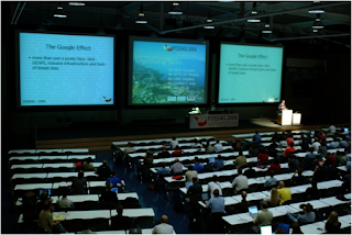
We started OSGeo-Live in 2008 with the aim of building a DVD of geospatial open source which was to be handed out at the international conference for free and open source software for geospatial, or FOSS4G. The FOSS4G conference provides an attractive international marketing pipeline that we could offer projects. And as some of us were on the FOSS4G organising committee we were able to say, "if you get your application installed on OSGeo-Live, then we will hand this DVD out to all attendees at this highly targeted conference".
We laid out a very clear vision of our target deliverable - namely a stable release of Open Source and accompanying marketing documentation. This clear and simple goal helped us many times by providing a framework to test the multitude of decisions that are inevitably encountered in such a project.The process of building our first version of OSGeo-Live involved installing geospatial applications on a base Ubuntu distribution. We followed install instructions, configured applications, resolved dependencies and conflicts, asked questions on email lists, and finally, after much hard work, we produced our first release for the 2008 FOSS4G conference. This was a very important first step as it showed that we had the commitment to follow through and deliver.
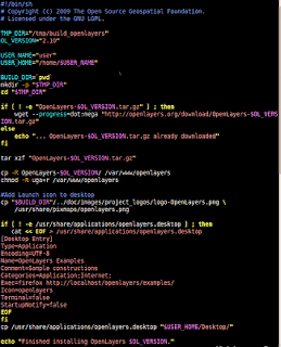
However, it also highlighted a number of our failings. We had followed a fully manual install process, so when the next Ubuntu release came out, we had to start the installation process again, from scratch. This was completely unsustainable. We needed to automate the install process, and we needed projects to show us how.
But our first calls for help from projects was embarrassingly underwhelming. You see, the perceived learning curve for a developer to learn the intricacies of packaging was considered unacceptably high and volunteers were not stepping up.
To fix this, we got one of our packagers to write an example install script along with clear, step-by-step instructions. We then went back to developers with the message of "if you can spend a couple of hours writing a short install script which looks like this, then we will market your application on the OSGeo-Live DVD".
Small effort / High Value. And this worked! 28 projects packaged their applications for our 2.0 release.
We followed the same process with documentation, as our first round of documentation was mostly written by developers and as such was quite ... variable. So the Australian Office of Spatial Data Management stepped up and sponsored one of LISAsoft's technical writers to create a template Project Overview, along with writing instructions. We then asked projects to write the documentation, and the technical writer followed up with documentation reviews, then all the documents went through our publishing pipeline in order to produce consistent, quality material. So by applying a template / write / review / publish process, we were able to achieve significant efficiencies by allowing experts to focus only on the bits they do best and thus reduce the cost of contributing.
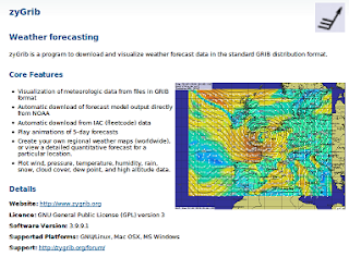
Another key to our success is that OSGeo-Live doesn't provide free rides for projects. If a project's community doesn't write installers and documentation, then they don't gain the marketing value of OSGeo-Live. This creates the business incentive for projects to help. It also frees up the core OSGeo-Live team to support a multitude of projects.
And by multitude, I mean 50 odd, and 70 odd volunteers, which becomes a project management challenge for a flat organisation structure like ours. To reduce swamping everyone with emails, each project nominates at a contact person to liaise between their project and OSGeo-Live. We use a wiki, issue tracker, email lists, and Google Doc spreadsheets and follow standard project management processes of managing a schedule and tracking status.
The simple statement of "if you want your application on the next release, it needs to be packaged this week" has been a motivating trigger for many of our volunteers to get started.
But the key motivator, along with the fun aspect of working on open source, is that there is a strong business case for each of our contributors to be involved.
  • Application developers get valuable marketing, and get their documentation reviewed and translated.
  • Our packagers' jobs are a lot easier because domain expects now take ownership of a large part of the packaging task.
  • By just sponsoring documentation review, The Australian government's Office of Spatial Data Management gained a 5 to 1 return on investment when creating Project Overviews
  • Translators gain quality source documentation and marketing pipeline.
  • LISAsoft, who build geospatial systems using Open Source, have increased public acceptance of Open Source, by helping coordinate OSGeo-Live.
  • For only the cost of printing, conference and workshop organisers impress delegates by giving them a free, comprehensive DVD of software.
  • Likewise, the OSGeo Foundation is gets comprehensive, translated documentation of projects which can be put on its website.
Everyone is a winner!
So if I come back to my opening statement of "what is required to tap into, and coordinate the expertise of hundreds of world leading experts, and have them volunteer their time for free?" I guess I'd say:
  • Start with a clear and compelling vision; inspiring enough that others want to adopt it and work to make it happen.
  • This should be followed by a practical and believable commitment to deliver on the vision. Typically this is demonstrated by delivering a “Minimum Viable Product”. 
  • Be in need of help, preferably accepting small modular tasks with a low barrier to entry, and ideally something which each person is uniquely qualified to provide. If anyone could fix a widget, then maybe someone else will do it. But if you are one of a few people with the skills to do the fixing, then your gift of fixing is so much more valuable, and there is a stronger moral obligation for you to step up.
  • Set a quality bar, and only accept contributions which achieve this level of quality.
  • Ensure that every participant gets more out of the project than they put in.
  • Avoid giving away free rides. If you are giving away something uniquely valuable; and it costs you time to provide that value for your volunteers; then it is okay to expect something from your volunteers if they wish to get something in return.
  • Use templates and processes to facilitate domain experts working together.
  • Reduce all barriers that may prevent people from contributing, in particular, by providing step-by-step instructions.
  • Set a schedule and work to it.
  • Talk with your community regularly, and promptly answer queries.
  • And most of all, have fun while you are doing it. Because believe you me, it is hugely rewarding to share the team camaraderie involved in building something that is much bigger and better than you could possibly create by yourself.

Wednesday, 1 June 2011

Australian Government defines Policy for Opening Public Sector Information


Australian Government are continuing their Gov 2.0 agenda, by releasing policy defining the Principles on Open Public Sector Information. It focuses on ensuring that "data be freely available, easily discoverable, understandable, machine-readable and reusable".

The principles are:
  1. Open access to information – a default position
  2. Engaging the community
    • ... consult the community in deciding what information to publish ...
  3. Effective information governance
  4. Robust information asset management
  5. Discoverable and useable information
    • ... published in an open and standards-based format and is machine-readable
    • attach high quality metadata ...
  6. Clear reuse rights
    • ... the default licence condition should be the Creative Commons BY open license.
  7. Appropriate charging for access
    • ... agencies to facilitate public access to information at the lowest reasonable cost.
  8. Transparent enquiry and complaints processes
Press Release: http://www.oaic.gov.au/news/media_release_principles_public_sector_info.html
Policy: http://www.oaic.gov.au/publications/agency_resources/principles_on_psi_short.pdf
Image Source: http://usedbooksblog.com/blog/wp-content/uploads/2008/12/trinity-college-library-dub.jpg

Sunday, 24 April 2011

Secrets of Mashup Design

This presentation covers high level design tips for building Mashup Websites, presented to surveyors, business people and other members from the Australian Surveying and Spatial Science Institute. It profiles readers and how they interact with web pages, the technical strengths and weaknesses of mashup technologies, which leads into defining best practice for building mashup websites. You can see the full 18 minute presentation below, and at: http://cameronshorter.blip.tv/file/5068745/

Friday, 1 April 2011

A Guide to Open Source Software for Australian Government Agencies


The Australian government have released a draft of their revised Guide to Open Source Software for Australian Government Agencies. You can add comments on their blog until 15 April 2011. This guide outlines 3 principles:
1. Agencies will be required to insert a statement into any Request for Tender that they will consider open source software equally alongside proprietary software.

2. Australian Government agencies will require suppliers to consider all types of available software (including but not limited to open source software and proprietary software) when responding to agencies' procurement requests.

3. Australian Government agencies will actively participate in open source software communities and contribute back where appropriate.

Image source: http://www.mspmentor.net/wp-content/uploads/2008/11/open_source.gif

Monday, 28 March 2011

OSGeo-Live 4.5, the Open Source Geospatial DVD, released

Version 4.5 of the OSGeo-Live GIS software collection has been released. OSGeo-Live is a self-contained bootable DVD, USB flash drive and Virtual Machine based upon Ubuntu Linux that is pre-configured with a wide variety of robust open source geospatial software. The applications can be trialled without installing anything on your computer, simply by booting the computer from the DVD or USB drive.Highlights:
  • 45 Quality GeoSpatial Open Source applications installed and pre-configured
  • Quality free world maps
  • One page overviews and quick starts for all applications
  • Overviews of key OGC standards
  • Translations for Greek, German, Polish, Spanish and Japanese
Packages:
  • 52º North SOS (Sensor Observation Service) 3.1.1
  • 52º North WPS (Web Processing Service) 2.0 RC6
  • AtlasStyler (Feature Style Editor) 1.6
  • deegree (Web Services) 2.3
  • GDAL/OGR (GeoSpatial Data Translation Tools) 1.7.3
  • GeoKettle (Business Intelligence) 3.2.0-20090609
  • Geomajas (Browser GIS Client) 1.8
  • GeoNetwork (Metadata Catalog) 2.6.3
  • Geopublisher (Electronic Library Manager) 1.6
  • GeoServer (Web Service) 2.1rc1
  • GMT (Generic Mapping Tools) 4.5.1
  • GpsDrive (GPS Navigation Software) 2.11
  • GRASS GIS (Fully featured GIS) 6.4.0
  • gvSIG Desktop (Desktop GIS) 1.10
  • Kosmo Desktop (Desktop GIS) 2.0
  • Mapbender (Geoportal Framework) 2.7
  • MapFish (Web Mapping Framework) 2.0
  • MapGuide Open Source (Web Service) 2.2.0
  • Mapnik (Cartographic rendering engine) 0.7.0
  • MapServer (Web Service) 5.6.6
  • MapTiler (Tiled Map Publishing) 1.0beta2
  • Marble (3D desktop globe) 0.9.5
  • MB-System (Sea floor mapping) 5.2.1880
  • OpenCPN (Marine GPS navigation) 2.3.1
  • OpenJUMP GIS (Desktop GIS) 1.4.0.1
  • OpenLayers (Browser GIS Client) 2.10
  • osgEarth (Terrain rendering toolkit) 2.0
  • OpenStreetMap (Tools for mapping the world) 3751
  • OSSIM (Image Processing) 1.8.10
  • OTB - ORFEO Toolbox Library (Image Processing) 3.8.0
  • pgRouting (GIS Tools) 1.05
  • PostGIS (Spatial Database) 1.5.2
  • Prune (GPS Track Editing) 10-1 Lucid
  • Quantum GIS (Desktop GIS) 1.6.0
  • QGIS mapserver (Web Service) 1.6.0
  • Rasdaman (Multi-Dimensional Raster Database) 8.1
  • R Spatial (Statistical Programming) 2.12.1
  • SAGA (Desktop GIS) 2.0.5
  • Sahana (Disaster management) Eden 0.5.3
  • SpatiaLite (Spatial Database) 2.4
  • uDig (Desktop GIS) 1.2.0
  • Ushahidi (Crowd Sourced Event Mapping) 2.0.1
  • Viking (Manage and plot GPS data) 0.9.9
  • ZOO Project (Web Processing Service) 1.2.0
  • zyGrib (Weather forecasting) 3.9.9.1

Credits:

Over 60 people have directly helped with OSGeo-Live packaging, documenting and translating, and thousands have been involved in building the packaged software.

Packagers and documenters: Alan Boudreault, Alex Mandel, Alexandre Dube, Andrea Antonello, Anton Patrushev, Astrid Emde, Brian Hamlin, Bruno Binet, Cameron Shorter, Dane Springmeyer, Daniel Kastl, Eike Hinderk Jürrens, Eric Lemoine, Etienne Dube, Fran Boon, François Prunayre, Gavin Treadgold, Gérald Fenoy, Hamish Bowman, Haruyuki Seki, Henry Addo, Ian Turton, Jody Garnett, Johan Van de Wauw, Jorge Sanz, Juan Lucas Domínguez Rubio, Judit Mays, Klokan Petr Pridal, Kristof Lange, Lance McKee, Manuel Grizonnet, Mark Leslie, Massimo Di Stefano, Michael Owonibi, Nathaniel V. Kelso, Pirmin Kalberer, Ricardo Pinho, Sergio Baños, Simon Pigot, Stefan A. Tzeggai, Stefan Hansen, Thierry Badard and Trevor Wekel

Translators: Aikaterini Kapsampeli, Angelos Tzotsos, Anne Ghisla, Argyros Argyridis, Astrid Emde, Christos Iossifidis, Daniel Kastl, Haruyuki Seki, Javier Sanchez, Jorge Sanz, Lars Lingner, Marco Puppin, Massimo Di Stefano, Milena Nowotaska, Nobusuke Iwasaki, Otto Dassau, Ruth Schoenbuchner, Thomas Baschetti, Valenty Gonzalez and Yoichi Kayama

Sponsoring institutions:

LISAsoft provides sustaining resources and staff toward the management and packaging of software onto the Live DVD. http://www.lisasoft.com

Information Center for the Environment at the University of California, Davis provides hardware resources and development support to the OSGeo Live project. http://ice.ucdavis.edu

The DebianGIS and UbuntuGIS teams provide and quality-assure many of the core packages.

The Australian Government's Office of Spatial Data Management sponsored reviews of software marketing documentation. http://www.osdm.gov.au

Tuesday, 1 March 2011

Australian Defence embrace interoperablity through standards


The Australian Defence Geospatial Strategy 2010 outlines how Defence intends to embrace the use of standards within a Service Oriented Architecture (SOA) for delivering geospatial functionality.
The application of Defence geospatial information and technology standards is vital to achieving a geospatially networked force. In order to allow geospatial information to be delivered seamlessly across the network from the strategic to the tactical level the capabilities that Defence acquires in the future must be able to ingest standard data formats. Non-compliance with standards will result in additional costs and delays in the acquisition of systems. Once operational, non-compliant platforms adversely affect interoperability and create an ongoing requirement to convert proprietary data formats into standard data formats resulting in systems that are expensive and unsupportable in the long term. It is important, therefore, that Geospatial Standards, including metadata standards, are collaboratively developed, managed and published across all of Defence.
This move toward standards will be particularly valuable for Australia's long term spatial capabilities as defence initiatives will also benefit geospatial services in government and private sectors.
[Image sourced from the Defence Geospatial Strategy 2010]

Thursday, 24 February 2011

Australian government embrace "pro-disclosure" of information


I've been hearing rumours that many Australian government departments are investigating how to publish their data online. This is justified by an amendment to Australian's Freedom of Information Act, published June 2010, which describes a pro-disclosure culture relating to information.
The changes are explained on the government website:
The objects of the FOI Act are a clear statement of the intention to promote disclosure of information held by government. The objects include to:
  • give the Australian community access to information by requiring agencies to publish the information, and provide a right of access
  • contribute to increased participation in government processes and increased scrutiny, discussion and review of government activities
  • increase recognition that information held by government is a national resource
  • promote public access to information, promptly and at the lowest reasonable cost.

Source: http://www.oaic.gov.au/foi/what.html#pro_disclosure_culture

Saturday, 29 January 2011

Australian government now to actively consider Open Source

The Australian Government has just released a policy stating that Open Source must be actively considered alongside proprietary Software. It notes:
Australian Government agencies must actively and fairly consider all types of available software (including but not limited to open source software and proprietary software) through their ICT procurement processes.
...

The Government’s previous policy, established in 2005, was one of ‘informed neutrality.’ This meant that agencies took an unbiased position that did not favour open source or proprietary software and procured the solution that was the best ’value for money’ and ‘fit for purpose’ for their specific requirement. Since then, there has been an increase in the maturity of the open source software products and the use of open source software by governments around the world. In recent years, many governments have revised their policies to increase the adoption of open source software.

This revised Australian Government policy on open source software will ensure that we maintain international best practice and that our purchases of software will continue to reflect best value for money for the Government.

This is a great first step, however, government purchasing practices will continue to inadvertently favour proprietary software until we see guidelines on how to compare the value Open Source and Proprietary Software which includes tools to assess the holistic value of Open Source. This is explained in the article Governments don’t know how to buy free software. A good starting point would be the European Union Guideline for Public administrations on Procurement and Open Source Software.

Friday, 26 November 2010

Goals and schedule for OSGeo-Live 4.5

We are starting to build the 4.5 OSGeo-Live DVD and want to hear from all included projects, translators, packagers, users, testers or others who wish to help improve OSGeo-Live. OSGeo-Live 4.5 will be released mid March 2011, ready for a number of big GeoSpatial conferences soon after.

Focus on this next release will be on improved Quality and Translating documentation.

Packaged projects - which version?

Could each project please tell us which version is intended to be included. Status is maintained here. Understanding what will, or will not change helps us coordinate reviewers and testers. We will be building from the Xubuntu 10.04 base, which is the same as last release.

If you have a established, stable project which you would like included on OSGeo-Live, then please talk to us about it.

Use Natural Earth dataset for examples

In order to ensure consistency and reduce disk space used, we ask that, where appropriate, examples use the common Natural Earth dataset, as explained here.

Translations

We expect to have main pages, Project Overviews and possibly OGC Standard Overviews translated into multiple languages for this next release. People have already translated much of the documentation into German, Spanish, Italian, Japanese and Greek.

Could all projects please update your English Project Overviews as soon as you can to give translators enough time to translate.

Please contact us if you are able to help with translation, or would like to translate a new language. The process is described here.

Quick Starts

Half the packaged projects had Quick Starts written for the last release (4.0) and we'd like to see Quick Starts for all projects for the next release. One of our users has volunteered to review Quick Starts for usability and help projects capture screen grabs. This is a big job and we'd like to hear from anyone else who'd can help out.

Again, could projects please update Quick Starts early to allow time for review and screen grabs.

User Testing

With ~ 50 applications to be packaged on the next OSGeo-Live, our core OSGeo-Live team have not had time to run all the Quickstart applications. We would really like some help. If you have very little experience with OSGeo software, then all the better, as you would be like a typical first time user of OSGeo-Live.

Running this user testing is one of the best ways to become familiar with the breath of OSGeo Software available. If interested, please join the OSGeo List, and start running Quick Starts as soon as they have been completed by projects.

OGC Standard Overviews

The OGC have already written one page overviews for half the OGC standards and have committed to writing up the remaining standards for then next release. We will be calling on the standards community to help review these standards to ensure they are accurate, clear and understandable.

Key Milestones

24 Jan 2011 Application Overviews ready for Review
31 Jan 2011 Application Feature Freeze
21 Feb 2011 Deliver to User Acceptance Test
14 Mar 2011 Final sent to printers

... full schedule

About OSGeo-Live

OSGeo-live is an XUbuntu based distribution of Geospatial Open Source Software, available via a Live DVD, Virtual Machine and soon to be released USB. You can use OSGeo-Live to try a wide variety of open source geospatial software without installing anything.

Contact Us?

Website: http://live.osgeo.org

Mailing List: http://lists.osgeo.org/mailman/listinfo/live-demo

or contact Cameron Shorter directly at: cameronD O TshorterATlisasoftD O Tcom.

Friday, 22 October 2010

EU Guidelines for Public Administrations purchasing software


The European Union has published excellent, very practical guidelines to support government agencies purchase software. While it is specifically targeted at purchasing Open Source Software, by its own admission, most of the discussion is valid for purchasing Proprietary Software too.
The key message that it describes in business terms, is the importance of using Open Standards in order to adhere to EU purchasing criteria of fair competition, transparency, and long term value for money.
The full guide is available here: https://joinup.ec.europa.eu/sites/default/files/OSS-procurement-guideline-public-final-June2010-EUPL-FINAL.pdf

Below are some of the highlights I picked out as I was reading it:

Government Business Drivers
Public sector consumers of software have an obligation to support interoperability, transparency and flexibility, as well as economical use of public funds. When it comes to public procurement, the principles applied to the public sector require them to support (and certainly not to harm) competition through their procurement practices.
Pro-Proprietary discrimination
Studies have shown that in practice, much software procurement discriminates between individual vendors, typically in favour of specific proprietary software companies.

E.g. OpenForum Europe, 2008. "OFE Monitoring Report: Discrimination in Public Procurement Procedures for Computer Software in the EU Member States", December. Ghosh, R. A. 2005. "An Economic Basis for Open Standards". FLOSSPOLS project, European Commission.

Proportion of Software Spent
While precise figures for the European public sector are not available, it is worth noting that the share of proprietary packaged software in European software spending is only 19%. Much more is spent on custom built software (52%) and internal software development (29%).
European Commission DG Enterprise, 2006, Study on the Economic impact of open source software on innovation and the competitiveness of the Information and Communication Technologies (ICT) sector in the EU, pp124 (Table 24). Available online at http://flossimpact.eu

Defining Standards
Note that compatibility with previously purchased IT solutions may seem like a very valid technical requirement, but can also be a way of perpetuating the consequences of previous purchasing decisions, perpetuating vendor lock-in and preventing an unbiased procurement based on real organisational needs. Requirements for compatibility with open standards and no proprietary elements, i.e. full compatibility across multiple vendors and producers, increases the freedom of future procurement choices.
Funding drivers for Government
Freed from the obligation of the short term financial cycles of the private sector, public organisations are also obliged to maximise costs effectiveness over the very long term. However, with limited, short-term budget cycles, they need to find a good balance between limiting the initial investments and limiting the overall, long term cost.
Exist Costs
The exit cost is also an important consideration: the cost incurred in migrating to another IT system, which should properly be accounted for as a cost not of the new system being migrated to, but the old system being migrated from. After all, if the old system were based on open standards, migration would not be as expensive, thus the cost of migration is imposed by the current, old system.
...
Software is used to create documents, databases and customised applications that, in the public sector, have a life-time that may be well beyond the originally announced life-time of the procurement procedure for the software. If the software originally purchased makes it difficult to use the documents, databanks and customised applications with similar software from other producers, then there is a high cost in terms of changing from the original software to another software - the exit cost.
...
Buying new software because it is compatible with previously purchased software may seem to save on migration and training costs. But when this software is proprietary, and is not fully based on protocols and standards that are fully and freely supported by other independent vendors, exit costs and associated costs may greatly increase over the long term. The agency's dependence on the proprietary vendor is increased. Thus the apparent short term benefit of compatibility is much reduced when considered over the longer term.
Total Cost of Ownership Studies

Total Costs of Ownership (TCO) is a term often cited in relation to software purchases. However, there are several different methodologies, and few include all the long-term costs involved in software purchases, such as the costs of required regular upgrades, or the exit cost of Guideline on Public Procurement of Open Source Software P. 31 migrating to another software. It is therefore difficult to use TCO studies, or even compare them.
Furthermore, such studies rarely evaluate anything other than quantifiable costs; the benefits of flexibility, independence and transparency while essential to a public organisation, may be qualitative and hard to quantify. Thus, it is advisable to analyse costs and benefits for the needs of the public organisation concerned, over the long term, rather than relying on TCO studies.
Open Source Quality Metrics
A number of EU funded research projects are examining open source quality metrics, such as QUALOSS and SQO-OSS (www.qualoss.org; www.sqo-oss.eu)
Lowering Company Financial Viability for Open Source
The main justification for financial sustainability criteria for software is to ensure that the supplier will be able to provide support as long as the software is being used.
With open source, the availability of the source code assures interoperability, and there is no dependence on the original supplier. If the original supplier goes out of business, the software can still be maintained by others; if others are not maintaining the software, the public agency can hire a third party maintainer. This increased sustainability of open source is justification for lowering the financial sustainability requirements, or lowering their weight in the selection process for tenders for open source software.
Valuing Open Source engagement in selection criteria
Public agencies can also provide indirect support for the development community, by asking tenderers for open source software or services to demonstrate their level of contribution to the appropriate developer community - as part of the selection process, and/or as part of the execution of the contract. In any case, this may be a useful way of determining level of knowledge of the open source software and its community available with the tenderer.