 |
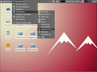
| OSGeo-Live Desktop |
Version 5.0 of the
OSGeo-Live GIS software collection has been
released.
OSGeo-Live is a self-contained bootable DVD, USB flash drive
and Virtual Machine based upon Ubuntu Linux that is pre-configured with a
wide variety of robust open source geospatial software.
The
applications can be trialled without installing anything on your
computer, simply by booting the computer from the DVD or USB drive.
A
DVD or USB of OSGeo-Live is being distributed to every delegate at the
upcoming international conference for Free and Open Source Software,
http://2011.foss4g.org.
- Homepage: http://live.osgeo.org
Highlights
- 47 Quality GeoSpatial Open Source applications installed and pre-configured
- Quality free world maps
- One page overviews and quick starts for all applications
- Overviews of key OGC standards
- Translations for Greek, German, Polish, Spanish and Japanese
Contents
Browser Clients
- OpenLayers 2.10 - Browser GIS Client
- Geomajas - 1.8 Browser GIS Client
- Mapbender 2.7.2 - Geoportal Framework
- MapFish 2.2 - Web Mapping Framework
- GeoMoose 2.4 - Web GIS Portal
Crisis Management
- Sahana Eden 0.5.5 - Disaster management
- Ushahidi 2.1 - Mapping and Timeline for events
Databases
- PostGIS 1.5 - Spatial Database
- SpatiaLite 2.3.1 / 2.4 beta - Lightweight Database
- Rasdaman 8.2 - Multi-Dimensional Raster Database
- pgRouting 1.05 - Routing for PostGIS
Desktop GIS
- Quantum GIS (QGIS) 1.7.0
- GRASS GIS 6.4.1
- gvSIG Desktop 1.11
- User-friendly Desktop Internet GIS (uDig) 1.2.2
- Kosmo Desktop 2.0.1
- OpenJUMP GIS 1.4.0.1
- SAGA 2.0.7
- OSSIM 1.8.6 - Image Processing
- Geopublisher 1.7 - Catalogue
- AtlasStyler 1.7 - Style Editor
- osgEarth 2.0 - 3D Terrain Rendering
Navigation and Maps
- GpsDrive 2.11 - GPS Navigation
- Marble 1.0.2 - Spinning Globe
- OpenCPN 2.5.0 - Marine GPS Chartplotter
- OpenStreetMap Tools - JOSM, Merkaartor, Gosmore, Osmarender
- Prune 12 - View, Edit and Convert GPS Tracks
- Viking 9.9.94 - GPS Data Analysis and Viewer
- zyGrib 5.0 - Weather Forecast Maps
Spatial Tools
- GeoKettle 2.0-RC1 - ETL (Extract, Transform and Load) Tool
- GDAL/OGR 1.8.0 - GeoSpatial Data Translation Tools
- GMT 4.5.2 - Cartographic Rendering
- Mapnik 0.7.1 - Cartographic Rendering
- MapTiler 1.0beta2 - Create Map Tiles
- OTB 3.10 - Image Processing
- R Spatial Task View 2.12.1 - Statistical Programming
Web Services
- GeoServer 2.1.1
- MapServer 6.0.1
- deegree 3.0
- GeoNetwork 2.6.4 - Metadata Catalog and Catalog Services for Web
- MapProxy 1.1.1 - Proxy WMS & tile services
- QGIS Server 1.7.0 - Web Map Service
- 52°North WSS 2.2.0 - Web Security Service
- 52°North WPS - 2.0 RC6 - Web Processing Service
- 52°North SOS - 3.2.0 Sensor Observation Service
- TinyOWS 1.0 - WFS-T Service
- ZOO Project 1.0.0 - Web Processing Service
Data
- Natural Earth 1.3.1 - Geographic Data Sets
- OSGeo's North Carolina, USA Educational dataset
- OpenStreetMap - Sample extract from OpenStreetMap
Geospatial Libraries
- GeoTools - Java GIS Toolkit
- MetaCRS - Coordinate Reference System Transformations
- libLAS - LiDAR Data Access
Credits
Over 80 people have directly helped with OSGeo-Live packaging,
documenting and translating, and thousands have been involved in
building the packaged software.
Packagers, documenters and translators include: Activity
Workshop, Agustín Díez, Aikaterini Kapsampeli, Alan Boudreault,
Alexandre Dube, Alex Mandel, Andrea Antonello, Andrea Yanza, Angelos
Tzotsos, Anne Ghisla, Anton Patrushev, Argyros Argyridis, Astrid Emde,
Brian Hamlin, Bruno Binet, Cameron Shorter, Christos Iossifidis, Dane
Springmeyer, Daniel Kastl, David Terrativa, Diego González, Dominik
Helle, Eike Hinderk Jürrens, Eric Lemoine, Etienne Dube, Fran Boon,
François Prunayre, Frank Gasdorf, Gavin Treadgold, Gérald Fenoy, Hamish
Bowman, Haruyuki Seki, Henry Addo, Hernan Olivera, Howard Butler, Ian
Turton, Jackie Ng, Jan Drewnak, Javier Sanchez, Jesús Gómez, Jim
Klassen, Jody Garnett, Johan Van de Wauw, Jorge Sanz, José Antonio
Canalejo, Judit Mays, Klokan Petr Pridal, Kristof Lange, Lance McKee,
Lars Lingner, Lucía Sanjaime, Mage Whopper, Manuel Grizonnet, Marco
Puppin, Mark Leslie, Massimo Di Stefano, Mauricio Miranda, Mauricio
Pazos, Michael Owonibi, Mike Adair, Milena Nowotarska, Nathaniel V.
Kelso, Ned Horning, Nobusuke Iwasaki, Oliver Tonnhofer, Òscar Fonts,
Otto Dassau, Pedro-Juan Ferrer, Pirmin Kalberer, Ricardo Pinho, Ruth
Schoenbuchner, Samuel Mesa, Sergio Baños, Simon Cropper, Simon Pigot,
Stefan A. Tzeggai, Stefan Hansen, Steve Lime, Thierry Badard, Thomas
Baschetti, Trevor Wekel, Valenty Gonzalez, and Yoichi Kayama.
Sponsoring organisations:


