Thursday, 8 April 2010

2 International GeoSpatial Standards meetings coming to Australia

The two key organisations leading the development of geospatial standards internationally—the Open Geospatial Consortium (OGC) and the International Organization for Standardization Technical Committee on Geographic information/Geomatics (ISO/TC211)will be holding their Technical Meetings in Australia in November and December 2010.

This is the first time for over 10 years these two organisations are meeting in the same location, and it is also the first time that OGC Technical Committee has met in Australia. This is in recognition of Australia’s role in contributing to International Standard’s development and the leadership shown in promoting the adoption of these standards.

ISO/TC211 and OGC have developed a range of standards to advance geospatial interoperability, enabling spatial data and information to interact with relevant services and also to interact with other business processes in a seamless and integrated manner. In Australia, the application of these standards is essential in developing such capabilities as national water accounting, the Australian and New Zealand Spatial Marketplace and numerous other government and commercial capabilities.

Any user of spatial capability benefits from the ISO and OGC standards in numerous ways and as an early adopter of many of these standards, Australian organisations have developed considerable knowledge of these standards. Australia has played a role in developing these standards and can continue to play a significant role in their ongoing development. Australia’s influence in this area is acknowledged by both ISO and OGC through their holding of their critical technical meetings in Australia this year.

LISAsoft are proud to be one of Australia's key supporters of OGC standards development through our participation in OGC testbeds and standards writing projects, and welcome the International community to join us in Australia.

“Standards are the foundation of the spatial capabilities we use across government, commercial, research and education sectors. The concept of sharing spatial resources which is undertaken through standards-based interoperability technologies would not be possible without the efforts of ISO and OGC. Standards are usually well hidden from most users of spatial technologies, but it is essential that we understand the role they play and also that the Australian spatial community continues to actively support both their ongoing development and the adoption in our evolving systems. Australia is fortunate to be the location for these significant meetings and will hopefully take full advantage of having this body of knowledge in the country.”

Ben Searle General Manager

Australian Government Office of Spatial Data Management

OGC Technical Meeting

Sydney, 29 November – 3 December 2010

Contact: Dr David Lemon

ISO/TC211 Meeting

Canberra, 6–10 December 2010

Contact: Chris Body

Monday, 29 March 2010

OSGeo Live DVD and Virtual Machine released

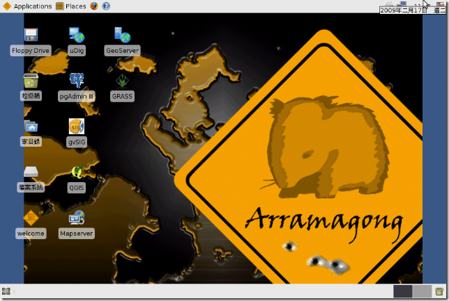
The Geospatial LiveDVD team is pleased to announce version 3.0 of the OSGeo GeoSpatial Live DVD and Virtual Machine, code named Arramagong.

From the Arramagong LiveDVD, you can try the best of GeoSpatial Open Source Software(OSS) without installing any applications on your computer. As a royalty free, reference release with fully tested and configured OSS stack, the LiveDVD is ideal for training, demonstration and public outreach.

The LiveDVD is based on XUbuntu 9.10 so it can be run on most computers simply by rebooting the computer with the DVD inserted. The Arramagong LiveDVD also comes with Windows and Macintosh installers for many of the GeoSpatial applications too.

Highlights from this 3.0 release include:

  • 34 of the best GeoSpatial Open Source applications included.
  • 14 new applications added since release 2.0, at FOSS4G 2009
  • 13 applications updated
  • Formalised testing introduced for all packages as part of the release process
  • Plus lots of general improvements and fixes

Downloads:

http://download.osgeo.org/livedvd

Packages:

  • AtlasStyler SLD editor and Geopublisher :: 1.4 (new)
  • deegree WMS, WFS, WCS and iGeoPortal :: 2.2
  • GDAL :: 1.6.3
  • GeoKettle :: 3.2.0-20090609
  • Geomajas :: 1.4.2 (new)
  • GeoNetwork :: 2.4.2
  • GeoServer :: 2.0.1
  • GMT: The Generic Mapping tools :: 4.4.0 (new)
  • GpsDrive :: 2.10pre7
  • GRASS GIS :: 6.4.0rc5
  • gvSIG :: 1.9 stable
  • Kosmo :: 2.0 RC1
  • Mapfish :: 1.2 (new)
  • Mapnik :: 0.6.1 (new)
  • Mapserver :: 5.6.1
  • MapTiler :: 1.0 beta2
  • Marble :: 0.8.1
  • MB System :: 5.1.2
  • Octave Mapping Toolbox :: 3.0 / 1.0.7 (new)
  • Open Jump :: 1.3
  • Open Layers :: 2.8 (new)
  • OpenCPN :: 1.3.6 (new)
  • OpenStreetMap editors and tools :: JOSM svn1788, Gosmore svn20090624 (new)
  • osgEarth :: 1.3 (new)
  • Ossim/OssimPlanet :: 1.8.3 (new)
  • pgRouting :: 1.04
  • Postgres/PostGIS :: 8.4/1.4
  • PROJ.4 :: 4.7.0 (new)
  • QuantumGIS :: 1.4.0
  • R geostatistics :: 2.10.1
  • SpatiaLite :: 2.4.0 (new)
  • uDig :: 1.2RC1
  • Unofficial gvSIG Mobile for Linux :: 0.1.6 (new)
  • Xubuntu :: 9.10

Interested?

You can find more details about the project on our wiki at: http://wiki.osgeo.org/wiki/Live_GIS_Disc

Us packagers are keen to help projects make use of the next release of the Live DVD at this year's OSGeo FOSS4G conference, http://2010.foss4g.org. Can you use the Live DVD in your presentations, tutorials or workshops? Talk to us about it.

Tuesday, 23 March 2010

OSGeo Live DVD joins Google Summer of Code

Us packagers at the OSGeo Live DVD project are pleased to announce that we have joined other OSGeo projects in offering students the opportunity to get paid and mentored creating great Geospatial Open Source Software as part of the Google Summer of Code program.

From the Live DVD, you can trial the best GeoSpatial Open Source Software without installing any applications on your computer. It is ideal for use in training courses and handing out to people wanting to try GeoSpatial Open Source for the first time.

We are looking for keen developers to help us improve our cross project infrastructure, in particular focusing on quality through the development of systematic testing processes. This will be a great opportunity for students who would like to gain a breath of knowledge across the GeoSpaital Open Source development stack.

More details at:

http://wiki.osgeo.org/wiki/Live_GIS_Disc_GSoC_2010

Friday, 5 March 2010

Does your favourite OSGeo application work on the LiveDVD?

This weekend, we will be cutting our last release candidate of the 3.0 LiveDVD which is targeted to be handed out at at number of spatial conferences in the April->July 2010 time period.
The DVD is looking really good, we have updated a number of packages, as well as improvement the look and feel.
Our only problem is that us packagers don't have the expertise to verify that each of the applications have been installed and runs correctly, and we are asking for help to document 10 to 20 test steps for each package.
Could we please get some help filling in test steps for each project here:
http://wiki.osgeo.org/wiki/Live_GIS_Disc_Testing
We would like people to use the template format here:
http://wiki.osgeo.org/wiki/Live_GIS_Disc_Testing#template
Deegree has filled out an excellent set of steps as an example here:
http://wiki.osgeo.org/wiki/Live_GIS_Disc_Testing#deegree
We will take any test steps that people can provide us. Feel free to update existing steps, as we are aware that some are based against old versions of the DVD and don't follow the template.
If you have downloaded the one of the 3.0 DVDs, as per: http://download.osgeo.org , then please write test steps from there.
Alternatively, you can write against the click2try 2.0 browser based viewer of the Virtual Machine, as explained here:
http://wiki.osgeo.org/wiki/Live_GIS_Disc#Click2Try:_run_from_browser
Alternatively, use a default install of the software you have on your computer, which should be similar to the LiveDVD install.
Lastly, thanks in advance for your help. Providing these testing steps helps us provide a quality DVD we can all be proud to hand out at conferences.

Saturday, 27 February 2010

FOSS4G Registration Metrics


With excitement building around the 2010 conference for Free and Open Source Software for GeoSpatial, http://2010.foss4g.org, I think it is timely to share registration metrics from previous conferences (from 2006 to 2009).

Some key highlights from the metrics are:
  • FOSS4G traditionally attracts ~ 50% of its delegates from the locally hosted country, and up to 75% of its delegates from the local region. This highlights the value of moving the FOSS4G conference around the world as it boosts exposure to local communities. This metric also helps predict attendance numbers based on region population densities. Small nations in the middle of the Ocean, like Australia have less delegates to draw upon, but we should see big attendance numbers coming into Barcelona this year.
  • Over 80% of people heard about the conference virally, via a friend, email list, blog, etc. Despite us having contra-deals and advertisements with many geospatial magazines, only 1% heard about the conference through a magazine. Lesson for organisors: focus on viral marketing.
  • 3/4 of the delegates are technical.
  • Half the local registrations come in late, after the early bird registration. In Barcelona with expected high numbers, it might mean that the conference organisors will need to turn away late registrations.
I'd love to see some of these metrics built into map displays. If you are a mapping wizard, you might want to create some fancy maps with these figures. Please let me know if you do, and I'll reference them from this blog.

Saturday, 6 February 2010

LISAsoft awarded three innovation grants for SLIP Enabler


Over the last two years, Landgate has invited proposals for Developer Innovation Grants to build innovative applications that utilises the Shared Land Information Platform (SLIP). SLIP delivers web data services for a wide range of Western Australian and national geospatial data though a standards-based Spatial Data Infrastructure.

The SLIP Innovation Grants are awarded for innovative ideas in the development of commercial applications and new uses of SLIP datasets. LISAsoft is proud to be awarded three of five of this year’s grants.

“LISAsoft’s proposals fitted very closely with our users needs, and we see them providing significant value to the future of SLIP.” Darren Mottolini, Landgate Business Consultant.

Winning Ideas:

PostGIS Shapefile Loader GUI

The current process for appending a shapefile to an existing PostGIS table involves command line tools and scripts. This project will produce a GUI interface for loading a shapefile to a PostGIS database.

Automated Layer Creation

By streamlining the current manual process of metadata collection, agencies will be able to leverage SLIP for high currency data services.

Big Red Basemap Feedback

“Big Red” provides the ability to markup base map information with instructions to create, update and delete features and review update history from a web page. Crowd sourcing will be used to clean and improve datasets.

Would you like to work on innovative projects, using Geospatial Standards, Open Source, and Geospatial Technologies? LISAsoft is hiring. Contact me if interested.


Monday, 25 January 2010

LISAsoft hiring Open Geospatial Software Engineers


I wondered whether chairing the FOSS4G conference here in Australia would be good for LISAsoft business. I guess the answer must be yes, because LISAsoft has recently won a number of exciting Geospatial Open Standards and Open Source projects, and we are hiring people to help us complete them.
So if you like working with GeoSpatial, enjoy working on cutting edge standards (through OGC testbeds and the like), like getting paid to work on Open Source Software, like the idea of living in the warm, surf loving city of Sydney, Australia, then we might just have the perfect job for you.
We have job adds here:
Feel free to contact me to ask questions about the opportunity if interested.
c a m e r on. sho r ter AT lisa soft . com...
(image from http://farm4.static.flickr.com/3145/2442138291_806d8dfcde.jpg?v=0)

Saturday, 19 December 2009

Will there be an OSGeo Desktop shootout at FOSS4G 2010?

Delegates who voted for the FOSS4G 2009 presentations ranked the OSGeo comparison projects very highly, which is something I suggest hopeful FOSS4G 2010 presenters take note of, because competition for speaking slots will be fierce.

At FOSS4G 2009, 183 quality presentations were submitted, and there was only 85 speaking slots. In 2010 it is likely to be much harder, as there is expected to be 2 to 3 times more delegates and many more hopeful presenters.

In 2009 the community ranked potential presentations, and some of the highest ranked presentations targeted the comparison of popular packages. Unfortunately, there were only a few of these types of presentations.

The presentations were:
  • Ranked 2: The WMS Performance Shootout
  • Ranked 8: PostGIS and Oracle Spatial
  • Ranked 9: There is no alternative to Openlayers...? (discussing OpenLayers vs other AJAX clients)
The moral to the story is that delegates want to see how different projects compare, and to date we have had a shortage of such presentations (partly because they are a lot of work to set up).

However, I strongly suggest that projects start teaming together to put together such presentations for 2010.

In particular, I'd love to see comparisons between:
  • Geospatial Desktop applications
  • Geospatial Browser based applications
  • Geospatial Servers (WMS, WFS, Tiled Services at the very least)
The comparisons could cover some or all of:
  • performance
  • robustness
  • features
  • ease of setup or use
The tests should not be restricted to Open Source, but be open to proprietary vendors too. (ESRI and ERDAS were invited to participate in the 2009 WMS shootout, and it seems likely they will participate in 2010).

So who wants to participate?

Thursday, 17 December 2009

Planning for next year's GIS Live DVD


We are planning two Arramagong GIS Live DVD releases during 2010 and would like to know what applications and functionality people would like to contribute.

Arramagong is based on XUbuntu and GISVM, and allows you to try a wide variety of open source geospatial software without installing anything. It is currently available as:

The core success of the Arramagong LiveDVD is due to the simple yet powerful build scripts. All that is required for a relevant project to be incorporated into the LiveDVD is to write a bash shell script which installs the application onto an Ubuntu distribution. Hence, our last distribution attracted over 20 developers and from project announcement to a released distribution took under 6 weeks.

The stack of popular GeoSpatial Open Source Applications included on the Arramagong LiveDVD includes:

  • deegree
  • GDAL
  • GeoKettle
  • GeoNetwork
  • GeoServer
  • GpsDrive
  • GRASS
  • gvSIG
  • Kosmo
  • Mapfish
  • Mapnik
  • Mapserver
  • MapTiler
  • Marble
  • MB System
  • Open Jump
  • Open Layers
  • pgRouting
  • PostGIS
  • PROJ.4
  • QuantumGIS
  • uDig

Milestones

  • 24 Jan 2010: Version 3.0 Feature Freeze
  • 07 Mar 2010: Version 3.0 Final Release
  • 05 Jul 2010: Version 4.0 Feature Freeze
  • 16 Aug 2010: Version 4.0 Final Release (ready for FOSS4G 2010)

Ideas for future releases

  • Upgrade to Xubuntu 9.10

Should there be sufficient interest, we would like to address the following:

  • Upgrade packages to latest versions
  • Incorporate new Geospatial packages
  • General cleanup
  • Incorporate help, tutorials, and training material
  • Apply internationalisation

Interested?

You can find more details about the project on our wiki at: http://wiki.osgeo.org/wiki/Live_GIS_Disc

Then please contact our mailing list at: http://lists.osgeo.org/mailman/listinfo/live-demo or contact Cameron Shorter directly at: cameronD O TshorterATlisasoftD O Tcom.

Monday, 7 December 2009

FOSS4G Videos and Presentations online


Sydney, Australia. 7 December 2009. http://2009.foss4g.org

Presentations, videos and posters from the international conference for Free and Open Source Software for GeoSpatial are now online. So if you missed the conference, or couldn't attend all the sessions, you now have a second chance to participate. In particular, I strongly recommend viewing Paul Ramsey's thought provoking and entertaining keynote speech, " Beyond Nerds Bearing Gifts: The Future of the Open Source Economy", http://2009.foss4g.org/speakers/#Paul_Ramsey .

Almost all presentations, tutorials and workshop material has been collected, and we have videos of 2/3 of all the presentations.

About FOSS4G

http://2009.foss4g.org

FOSS4G is an international Free and Open Source Software for Geospatial conference, which was held in Sydney, Australia, 20-23 October 2009. FOSS4G offered presentations, workshops, demos, an install-fest, and a code sprint. It was presented by the world's best Developers, Policy Makers, Sponsors and Geospatial Professionals and included the latest geospatial applications, standards, government programs, business processes and case studies. Topics included mobile platforms, location based applications, crowd sourcing, cloud computing, development, spatial standards, integration of cross-agency data, Spatial Data Infrastructures, Sensor Webs, Web Processing Services, Integration of Open Source and Proprietary Software and more.

Media Sponsors

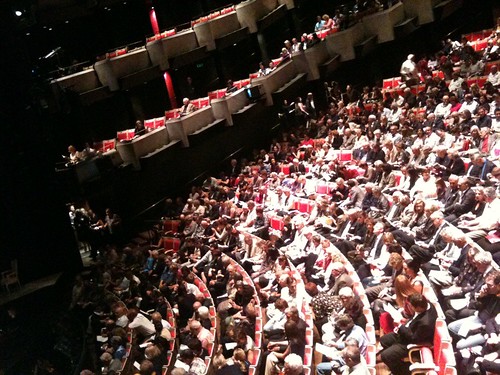
(photo: The main presentation hall at FOSS4G, courtesy of Raj Singh)

Friday, 20 November 2009

I published this article on 27 November 2007, under another blog (which has suffered link rot) so I'm republishing here for archiving.


Federated Geo-synchronization

Standards and tools for reliable data synchronization in Spatial Data Infrastructure and field based data collection.

Overview

This article describes the issues and technical solutions associated with Federated Geo-synchronization.

Lisasoft aims to contribute to these solutions as part of the OGC’s Open Web Services Testbed 5.2.

To strengthen and refine our requirements, we are looking for Agencies which would benefit from solutions identified here. Please leave a comment, or contact me if you are interested.

Technical Problem Statement

As spatial databases become distributed and collaboratively maintained, traditional database transaction models ineffectively handle modern scenarios.

Figure 1 Synchronising databases in a Spatial Data Infrastructure

Users require current data from remote agencies. Data may be stored on a slow or unreliable server or behind an unreliable internet connection.

Updates may come from remote field workers, trusted external organizations, or general internet users. Identities must be confirmed, updates validated and applied, or rolled back to a previous version.


Technical Design

Figure 2 Caching WFS-T in field, local and remote networks

This project will:

  • Make a Spatial Data Infrastructure (SDI) fast and robust by caching remote WFSs locally.

  • Provide WFS Synchronization to allow real time data updates between agencies.

  • Ensure interoperability between agencies and applications by proposing required extensions to Open Standards.

  • Ensure wide adoption by providing all components free as Open Source Software.

  • Provide desktop and mobile, field based data collection tools.

Version WFS-T

A Transactional Web Feature Service (WFS-T) provides an OGC standards compliant web interface for downloading and updating vector features over the internet. To date the WFS-T standard doesn’t address version history.

Versioned WFS-T enables users to roll back to previous versions, track update history, check differences between updates. A versioned WFS is required to support a cached WFS.

Version WFS-T Development

Geoserver developers have developed a Versioned WFS-T by extending the WFS-T specification to include standard version attributes. As at May 2007, the Geotools version code is complete, but still in alpha state. It requires configuration web pages to ease operator use, packaging into a release and real world testing.

The extensions to the WFS-T specification need to go through the OGC standards process.

Security

Security involves: authentication (to verify who a user is) and authorization (to specify what a user can view or update).

Security Development

Geoserver has prototype authorization and authentication code. Access is provided to the level of WFS. Granular access to a layer or a specific feature is not supported. The code still requires refinement, a user interface and integration with the baseline.

Clients like Udig, Mapbuilder and OpenLayers require security logic. Some of this will be addressed during the Canadian Geographic Data Infrastructure Interoperability Pilot, due to complete October 2007.

Cached WFS-T

A Cached WFS mirrors a remote WFS locally. A Cached WFS-T also caches WFS-T updates when disconnected from the remote WFS.

A Cached WFS-T is used when:

  • The remote WFS uptime is not guaranteed.

  • The remote WFS connection is unreliable or unable to handle traffic required.

Cached WFS-T depends upon the Version WFS-T protocol.

Cached WFS-T Development

An alpha version of Cached WFS (read only) is implemented by Geoserver. A friendly user interface is required to bring this to COTS quality.

Minimal development is required to implement Cached WFS-T (with writes) which has a basic conflict management interface.

Business rules for managing updates and conflicts from disconnected clients will be addressed in a second development phase.


Desktop Mapper

Figure 3 JGrass desktop mapping application

Desktop Mapping offers powerful data manipulation and analysis. There are a number of clients available both proprietary and open source with varying levels of functionality and standards compliance.

Desktop Mapper Development

A prime candidate for an Open Source Desktop Mapper is UDig and JGrass which are combining forces to provide:

  • User friendly mapping interface.

  • Extensive map analysis tools from Grass.

  • Access to numerous mapping format and data sources from Geotools.

  • Extensible architecture from Eclipse

Development is required to include:

  • Embedded cached WFS-T from Geoserver (developed but requires integration and testing)

  • Embedded data store using H2 (in development)

  • Access to images in a compressed format like ECW or JPG2000.

More work is required to add:

  • Business logic, views and reports to manage collaborative editing and information from a versioned WFS-T.


Mobile Mapper

Field operators need to create or update geographic data while in the field.

A typical use case involves:

  • Download geographic data while in the office

  • Disconnect from the network

  • Modify, create and delete features and datasets. Interface with a GPS to collect feature information.

  • Synchronize changes with local or remote data-stores via Standards compliant WFS-T protocol.

Mobile Mapper - Tablet Development

Figure 4 Ultra Mobile PC with slide down keyboard

A Tablet or Ruggedized PC provides the same operating environment as a desktop PC. So the Desktop Mapper will port directly to the Tablet.

Integration with a GPS is the only extra development required for the Mobile Tablet.

Mobile Mapper - PDA Development

Figure 5 Mapping on a PDA

PDAs are often used for field work because they are cheaper and smaller than laptops. Along with smaller size they are also less powerful and have less storage capacity.

Cut down versions of Windows (Windows CE) and Java (J2ME) run on most PDAs.

Investigation is required to determine effort required to port the Desktop Mapper to the PDA and whether alternative development would be more effective.

Browser Editor

Figure 6 Mapbuilder, a browser map editor/viewer

Browser editors efficiently enable data collection from the public or remote workers.

Browser clients can also publish public map data.

Browser Editor Development

Openlayers and Mapbuilder are working together to produce Open Source, Open Standards Browser Based mapping client. WFS-T editing is supported but needs to include business logic associated with user authentication and access rights.

Open Standards

Multiple agencies tend to run multiple technical solutions. This is fine so long as they interoperate through Open Standards.

The Versioned WFS-T protocol will be presented to the OGC to be formalized as an Open Standard.

Open Source

Free tools reduce entry costs to a Spatial Data Infrastructure which will maximize participation.

Open Source software already provides the majority of the functionality required by this project which means tools can be built for minimal cost.


Deliverables

Essential Deliverables

Essential Deliverables are required to meet immediate customer needs. These phases are low risk as the functionality already exists in tested or prototype code.

Phase 1: Mirror remote WFS locally

  • Cached WFS (view only). Builds upon Geoserver/PostGIS.

  • Standard UDig for WFS viewing

Phase 2: Update remote WFS-T from remote or disconnected client

  • Cached WFS-T (read/write). Builds upon Geoserver/PostGIS. Add simple update business rules.

  • Standard UDig for WFS-T editing

Phase 3: Security - Role based editing and views

  • Security added to Geoserver

  • Role based options available in UDig

Optional Deliverables

Optional Deliverables are nice to have and involve further development with associated risk.

Phase 4: Universal Client for easy install

  • UDig with embedded database (H2) and Cached WFS (Geoserver)

Phase 5: Universal Client on PDA

  • Port universal client to PDA

Schedule

OWS 5.1


RFQ (5.1) Issued

May 11, 2007

OWS 5.2


Revised RFQ issued

July 9, 2007

Questions Due & Bidders’ Conference

July 16, 2007 (TBR)

Clarifications Posted

July 23, 2007 (TBR)

RFQ Responses Due

August 3, 2007

Kickoff Meeting

week of September 10, 2007

Interim Milestone

week of November 12, 2007

Demonstration Milestone

week of January 7, 2008

Final Delivery

February 18 – February 22, 2008

Commercialize product, provide support, consulting and customized solutions.

March 2008 – 2009.


Friday, 16 October 2009

Try Open Source Geospatial desktop applications from a web browser

Sydney, Australia. 16 October 2009. http://2009.foss4g.org

The Arramagong/GISVM GeoSpatial Live DVD and Virtual Machine, which includes a stack of popular GeoSpatial Open Source Applications and is being handed out to delegates at the FOSS4G conference, can now be viewed from http://click2try.com from within your web browser!

All you need to do is:

  1. Click the big Try this application now button.
  2. Review the connection test results and fix, if necessary.
  3. Either wait for the application to launch or click the Launch App button.
  • Login to the Arramagong desktop using the login credentials in the Quick Start guide in the left pane of the window.
  • You should see the icons for the Geospatial applications on the desktop. You can start and try any application.
  • To save data, you'll need to apply for a free click2try account at http://www.click2try.com/component/user/?task=register.

About Arramagong

Arramagong is a self-contained live DVD and Virtual Machine, based on XUbuntu and GISVM, that allows you to try a wide variety of open source geospatial software without installing anything. It is composed entirely of free software, allowing it to be freely distributed, duplicated and passed around. A full list of installed packages is at: http://www.arramagong.com/Arramagong/contents.html

As explained by Cameron Shorter, coordinator of Arramagong and Geospatial Solutions Manager at LISAsoft,

"Arramagong allows users to easily try out the robust, feature rich stack of applications offered by Geospatial Open Source. It is a compelling marketing tool for us organisations who support Open Source."

About FOSS4G

http://2009.foss4g.org

FOSS4G is the international Free and Open Source Software for Geospatial conference, which comes to Sydney, Australia, 20-23 October 2009. FOSS4G offers presentations, workshops, demos, an install-fest, and a code sprint. It is presented by the world's best Developers, Policy Makers, Sponsors and Geospatial Professionals and includes the latest geospatial applications, standards, government programs, business processes and case studies. Topics include mobile platforms, location based applications, crowd sourcing, cloud computing, development, spatial standards, integration of cross-agency data, Spatial Data Infrastructures, Sensor Webs, Web Processing Services, Integration of Open Source and Proprietary Software and more.

About Click2Try

http://click2try.com/

click2try is an online Open Source application showroom that helps visitors easily evaluate and use Open Source Software from within their web browser. click2try employs a unique, advanced technology framework, built completely on Open Source software, to provide on-demand, multiuser, concurrent access to enterprise-level Open Source software applications.

Upcoming milestones

  • 20 Oct 2009, FOSS4G Workshop
  • 21-23 Oct 2009, FOSS4G Presentations and Tutorials
  • 24 Oct 2009, FOSS4G Code Sprint

Media Sponsors

Tuesday, 13 October 2009

7 Bridges Walk, after FOSS4G


Like to walk across seven of the grand Sydney bridges? On Sunday 25 October, after FOSS4G, there will be a 25km, city coordinated, 7 bridge walk. It will be a nice way to see the city (even if you only take on a few sections a catch a ferry back to the start). Details at: http://www.7bridgeswalk.com.au

Tall Ship sailing fun at FOSS4G


Want to sail Sydney Harbour in a tall ship and promote a safe climate at the same time? Then you will probably want a berth on this ship, sailing on Saturday 24 October, after the FOSS4G event. Details at http://ssec.org.au/350/
350 is the safe upper limit for carbon dioxide in our atmosphere. Published by leading scientists only last year, this target is already in the draft global climate treaty for negotiation at Copenhagen in December. But it’s just one option, along with other competing targets that we now know are dangerously weak.
On Saturday October 24th, people all around the world will be speaking with one voice. From the Great Barrier Reef to the Great Wall of China, at over 1500 events in 125 countries, the world will say: 350.
By cruising Sydney Harbour on the Southern Swan, you will help to make a powerful statement to the world’s leaders: we want a fair, ambitious and binding treaty that aims for success: restore a safe climate by bringing CO_2 back below 350.

Saturday, 3 October 2009

Arramgong GIS Live DVD - off to printers


After a hive of activity from a team of 20 or so people, we have a Geospatial Live DVD and Virtual Machine with a comprehensive collection of Open Source Geospatial Software. The Arramagong Live DVD was sent to the printers last week and will be handed out to all delegates at the international conference for Free and Open Source Software for GeoSpatial, http://2009.foss4g.org.
But probably more valuable than this specific release is the fact that we have automated the building of the LiveDVD so that anyone with a decent internet pipe can build themselves a customised GeoSpatial LiveDVD in 24 hours - a task that used to take months and was consequently a major development barrier.
As LISAsoft discovered when helping build the LiveDVD for FOSS4G 2008, there are a number of barriers to packaging. Ideally, all projects should package their applications in .deb files, aligned with DebianGIS and UbuntuGIS projects. Installing .deb files into a LiveDVD is as simple as:
apt-get install package.deb
However, there is a non-trivial learning curve for packaging applications for debian, and Java packaging is poorly supported, and there has been a knowledge gap between packagers, familiar with packaging, and developers familar with installing their specific application. So only a few of the popular GeoSpatial Open Source applications are easily installed on Linux. Most OSGeo applications need to be manually installed, and hence packaging for the FOSS4G 2008 LiveDVD and the GISVM involved dedicated developers putting in hero efforts to learn and apply the specific install instructions and dependencies for each project individually. It took months.
For FOSS4G 2009 we have been smarter. We asked projects to write a command line installer script for their packages, in line with a provided template. We then strung all the installers together in an automated master build process. This meant:
  1. An installer script is much easier to write than a .deb file, and hence we had many projects contribute.
  2. The automated build process meant we could release and test the Virtual Machines often, and involve the whole community in the testing cycle.
And as a by product, these scripts are the key element Debian packagers require to build .deb packages, so we should expect to see many of these projects appear in the next Debian and Ubuntu releases.
What next?
  1. Include install scripts for more applications
  2. Refine the user experience
  3. Align with OSGeo Education initiatives to provide training for each of the applications, via documentation, videos etc. and have this material included in the distribution.
  4. Target other media, like USB drives.
  5. Support targeted releases for specific purposes. (It is as simple as tweaking the install list if you want to create a targeted distribution).
  6. And I'm sure there are many other ideas. Tell us about them.
Credits
Many people worked very hard to get all these applications in place in such a short period of time. I'd like to thank you all for all the help. (I'd try and list you all, but I'm afraid I'd miss someone).

Friday, 2 October 2009

Australian Government initiative to set up an Open Technology Foundation

The South Australian Government, through the Office of the Chief Information Officer, have proposed to set up an "Open Technology Foundation" on behalf of Australian government which is:
  • a collaborative effort between governments, industry, academia, and communities of interest.
  • committed to the evaluation and where proven, uptake of open technologies, standards and methods.
  • exists to help governments make better, more cost effective and innovative use of open technologies in order to improve service delivery to citizens.
  • focused on openness in order to help agencies achieve more interoperability, independence, resilience and flexibility in their ICT operations.
They are currently looking for letters of support for their business plan before Wednesday 14 October 2009. An overview and webcast about the initiative can be found at http://www.cio.sa.gov.au/business/projects/open-technology-foundation .

Supporting governments embrace Open Technologies is an effective way to reduce government spending and I strongly support this.
In particular, Open Technologies facilitate cost savings by spreading development and maintenance costs between multiple agencies, both nationally and internationally. However, uptake of Open Technologies is often hindered by specific project purchasing guidelines which focus on immediate deliverables. People are not paid to spend the extra effort required to make an application easy to share. I suggest the business plan also focus on the development of purchasing guidelines which encourage Open Technologies and collaborative approaches.
Steve Schmid, the key person behind the initiative will be leading a FOSS4G in Government Birds of a Feather session at the FOSS4G conference in just over a week. Look out for him if you are going to the conference.

Wednesday, 23 September 2009

Rush on Geospatial Open Source Workshops at FOSS4G

Sydney, Australia. 23 September 2009. http://2009.foss4g.org

Many FOSS4G workshops are close to full, with one workshop already at capacity. http://2009.foss4g.org/workshops/ People wanting to learn about Geospatial Standards, Geospatial Open Source Software and Business Cases should sign up soon to avoid disappointment.

Also, in Open Source tradition, there is a breadth of other exciting activities to sign up for:

About FOSS4G

FOSS4G is the international Free and Open Source Software for Geospatial conference, which comes to Sydney, Australia, 20-23 October 2009. FOSS4G offers presentations, workshops, demos, an install-fest, and a code sprint. It is presented by the world's best Developers, Policy Makers, Sponsors and Geospatial Professionals and includes the latest geospatial applications, standards, government programs, business processes and case studies. Topics include mobile platforms, location based applications, crowd sourcing, cloud computing, development, spatial standards, integration of cross-agency data, Spatial Data Infrastructures, Sensor Webs, Web Processing Services, Integration of Open Source and Proprietary Software and more.

Media Sponsors


For more information or to keep informed from the FOSS4G Organising Committee, join our email list or twitter feed at: http://2009.foss4g.org/about_us/

Friday, 11 September 2009

Mark is trialling Sydney entertainment for us


One of the perks of running a conference is that you are occasionally given free tickets to shows, or harbour cruises or the like, in the hope that we might write a blog like this and tell all our international friends to go see the show.
So Mark Leslie, who has been flat out sorting out workshops and other things, has volunteered to check out the "Wicked" musical currently running in Sydney. Thanks Mark.

Sunday, 6 September 2009

What windows installers should be on the FOSS4G Live DVD?


Sydney, Australia. 6 September 2009. http://2009.foss4g.org

The Arramagong Live DVD / GISVM email list has been running hot last week, with ~ 15 people helping write install scripts for projects in order to meet our feature freeze deadline tomorrow, Monday 7 September.

The list of linux projects currently being packaged for the FOSS4G LiveDVD are:

PostGIS ,GeoServer ,Mapserver ,GRASS ,Qgis ,gvSIG ,uDig ,Open Layers ,GeoNetwork ,Open Jump ,Deegree ,GpsDrive ,mapnik ,MB System ,pgRouting ,52 North Sensor Observation Service ,Mapfish ,Marble.

Our next steps are:

  • Package up the windows installers for the Live DVD. Please tell us what installers are available, and where they are located, by updating the following ticket: http://trac.osgeo.org/osgeo/ticket/424
  • Write introductory documentation for all projects
  • Test the image and iron out any issues we find before users find them. (I'm hoping communities will step up and test their favourite applications starting next week.)
  • Plus lots of little things

Details for getting involved are at: http://wiki.osgeo.org/wiki/Live_GIS_Disc and we hang out at irc://freenode.net#foss4g

Live DVD Timeline

Date Date Milestone
7 Sep 2009 in 1 day LiveDVD Feature Freeze
11 Sep 2009 in 1 week LiveDVD Beta Release
18 Sep 2009 in 2 weeks LiveDVD Final Freeze
20 Sep 2009 in 2 weeks LiveDVD Final Release & sent to printers

About GISVM

GISVM is a Free(dom) and ready to use anywhere Geographic Information System Virtual Machine. Based on the amazing Virtualization technology it can be used on almost any operating system environment and is intended to be a hassle-free installation option for anyone that needs a ready to use GIS solution.

About Arramagong Live DVD

The Arramagong Live DVD provides a stack of most of best Geospatial Open Source software, pre-configured with sample data. It is based on the XUbuntu linux operating system and also contains windows installers. A FOSS4G 2009 release of Arramagong will be given to all delegates at the FOSS4G conference. It has been built by LISAsoft in conjunction with the Open Source Geospatial community.

About FOSS4G

FOSS4G is the international Free and Open Source Software for Geospatial conference, which comes to Sydney, Australia, 20-23 October 2009. FOSS4G offers presentations, workshops, demos, an install-fest, and a code sprint. It is presented by the world's best Developers, Policy Makers, Sponsors and Geospatial Professionals and includes the latest geospatial applications, standards, government programs, business processes and case studies. Topics include mobile platforms, location based applications, crowd sourcing, cloud computing, development, spatial standards, integration of cross-agency data, Spatial Data Infrastructures, Sensor Webs, Web Processing Services, Integration of Open Source and Proprietary Software and more.

Upcoming FOSS4G milestones

  • 14 Sep 2009, Final program available
  • 21 Sep 2009, Poster Submission closes
  • 20 Oct 2009, FOSS4G Workshop
  • 21-23 Oct 2009, FOSS4G Presentations and Tutorials
  • 24 Oct 2009, FOSS4G Code Sprint

Media Sponsors


For more information or to keep informed from the FOSS4G Organising Committee, join our email list or twitter feed at: http://2009.foss4g.org/about_us/

or contact:

Cameron Shorter, Chair of the FOSS4G Organising Committee and Geospatial Systems Architect at LISAsoft

tel +61-2-8570-5050

c a m e r o n . s h o r t e r @ l i s a s o f t . c o m

Friday, 4 September 2009

More about Australia's Digital Regions Initiative


I attended a briefing about Australia's Digitial Regions Initiative which is co-funding projects to help regional education, health, and disaster response projects. (previous description).
The key take home points for me were:
  • The Expression of Interest, due 14 September 2009, is aimed at identifying potential projects, and giving parties the opportunity to find each other and collaborate on the final proposal, to be lodged by 14 October.
  • I asked whether it was in scope to propose an Open Street Map style application, which facilitates community collection, cleaning, and collaboration around spatial and attribute data. This was certainly considered in scope, if the value to communities could be demonstrated. Value is based upon the number of people serviced, the value presented to each person, and whether the service is filling an existing gap.
  • The initiative is expecting to fund 50% of multi-million dollar projects. However, smaller projects will be considered, so long as they can demonstrate appropriate value. External funding sources (and I'm specifically thinking about co-funding with international government programs) would be acceptable.

Saturday, 29 August 2009

The Easy steps to get your project on the FOSS4G Live DVD


The Arramagong Live DVD, GISVM, and OSGeo Live-Demo projects are collaborating to create a set of simple, automated install scripts for a wide variety of Free and Open Source GIS projects, and we're calling on each project to help us write a script for their software. Projects that can write their install script this week will be included on The Arramamgong Live DVD which will be given to all delegates at the FOSS4G conference.

The scripts should cover the installation and configuration of each project into a base Xubuntu 9.04 system. Separate scripts can optionally cover data, demos and tutorials. As a bonus, these scripts are exactly what packagers require to bundle your project into Debian and Ubuntu, so you will be taking the first steps toward getting your project into a Linux distribution.

The base version of the FOSS4G2009 GISVM/Arramagong Live DVD can be trialled as a VMWare virtual machine and downloaded from: http://download.osgeo.org/livedvd/Arramagong_GISVM_FOSS4G2009_alpha1.7z

Timeline

Date Date Milestone
7 Sep 2009 in 1 week LiveDVD Feature Freeze
11 Sep 2009 in 2 weeks LiveDVD Beta Release
18 Sep 2009 in 3 weeks LiveDVD Final Freeze
20 Sep 2009 in 3 weeks LiveDVD Final Release & sent to printers

Packaging Howto

For projects already packaged for Ubuntu or DebianGIS, an install script will likely be as simple as:

install_mapserver.sh

#!/bin/sh
apt-get install cgi-mapserver


Projects that haven't been packaged yet are slightly more complicated:

install_udig.sh

#!/bin/sh
#################################################
#
# Purpose: Installation of udig into Xubuntu
# Author: Stefan Hansen
#
#################################################
# Copyright (c) 2009 Open Geospatial Foundation
# Copyright (c) 2009 LISAsoft
#
# Licensed under the GNU LGPL.
#
# This library is free software; you can redistribute it and/or modify it
# under the terms of the GNU Lesser General Public License as published
# by the Free Software Foundation, either version 2.1 of the License,
# or any later version. This library is distributed in the hope that
# it will be useful, but WITHOUT ANY WARRANTY, without even the implied
# warranty of MERCHANTABILITY or FITNESS FOR A PARTICULAR PURPOSE.
# See the GNU Lesser General Public License for more details, either
# in the "LICENSE.LGPL.txt" file distributed with this software or at
# web page "http://www.fsf.org/licenses/lgpl.html".
#

# About:
# =====
# This script will install udig into Xubuntu

# Running:
# =======
# sudo ./install_udig.sh

TMP="/tmp/udig_downloads"
INSTALL_FOLDER="/usr/lib"
DATA_FOLDER="/usr/local/share"
UDIG_FOLDER="$INSTALL_FOLDER/udig"
BIN="/usr/bin"
USER_NAME="user"
USER_HOME="/home/$USER_NAME"

## Setup things... ##

# check required tools are installed
if [ ! -x "`which wget`" ] ; then
echo "ERROR: wget is required, please install it and try again"
exit 1
fi
# create tmp folders
mkdir $TMP
cd $TMP


## Install Application ##

# get udig
if [ -f "udig-1.2-M6.linux.gtk.x86.tar.gz" ]
then
echo "udig-1.2-M6.linux.gtk.x86.tar.gz has already been downloaded."
else
wget http://udig.refractions.net/files/downloads/branches/udig-1.2-M6.linux.gtk.x86.tar.gz
fi
# unpack it and copy it to /usr/lib
tar -xzf udig-1.2-M6.linux.gtk.x86.tar.gz -C $INSTALL_FOLDER


## Configure Application ##

# Download modified startup script for udig
if [ -f "udig.sh" ]
then
echo "udig.sh has already been downloaded."
else
wget https://svn.osgeo.org/osgeo/livedvd/gisvm/trunk/udig-conf/udig.sh
fi
# copy it into the udig folder
cp udig.sh $UDIG_FOLDER

# create link to startup script
ln -s $UDIG_FOLDER/udig.sh $BIN/udig

# Download desktop icon
if [ -f "uDig.desktop" ]
then
echo "uDig.desktop has already been downloaded."
else
wget https://svn.osgeo.org/osgeo/livedvd/gisvm/trunk/udig-conf/uDig.desktop
fi
# copy it into the udig folder
cp uDig.desktop $USER_HOME/Desktop
chown $USER_NAME:$USER_NAME $USER_HOME/Desktop/uDig.desktop


## Sample Data ##

# Download udig's sample data
if [ -f "data-v1_1.zip" ]
then
echo "data-v1_1.zip has already been downloaded."
else
wget http://udig.refractions.net/docs/data-v1_1.zip
fi
#unzip the file into /usr/local/share/udig-data
mkdir $DATA_FOLDER/udig-data
unzip data-v1_1.zip -d $DATA_FOLDER/udig-data


## Documentation ##

# Download udig's documentation
if [ -f "udig-1.2-M5.html" ]
then
echo "udig-1.2-M5.html has already been downloaded."
else
wget http://udig.refractions.net/files/downloads/branches/udig-1.2-M5.html
fi

if [ -f "uDigWalkthrough1.pdf" ]
then
echo "uDigWalkthrough1.pdf has already been downloaded."
else
wget http://udig.refractions.net/docs/uDigWalkthrough1.pdf
fi

if [ -f "uDigWalkthrough2.pdf" ]
then
echo "uDigWalkthrough2.pdf has already been downloaded."
else
wget http://udig.refractions.net/docs/uDigWalkthrough2.pdf
fi

#copy into /usr/local/share/udig-docs
mkdir $DATA_FOLDER/udig-docs
cp udig-1.2-M5.html $DATA_FOLDER/udig-docs
cp uDigWalkthrough1.pdf $DATA_FOLDER/udig-docs


As we are still bootstrapping the packaging project, and as we are very short on time before feature freeze, manual steps can be included as comments in each install script, and can be automated by a project member, or packager at a later date.

Packaging details and examples can be found at: http://wiki.osgeo.org/wiki/GISVM_Build

And help is available on the Live-Demo mailing list via Cameron Shorter, Stefan Hansen, Ricardo Pino, Hamish Bowman, Alex Mandel, Massimo de Stefano and others.

About GISVM

GISVM is a Free(dom) and ready to use anywhere Geographic Information System Virtual Machine. Based on the amazing Virtualization technology it can be used on almost any operating system environment and is intended to be a hassle-free installation option for anyone that needs a ready to use GIS solution.

About Arramagong Live DVD

The Arramagong Live DVD provides a stack of most of best Geospatial Open Source software, pre-configured with sample data. It is based on the XUbuntu linux operating system and also contains windows installers. A FOSS4G 2009 release of Arramagong will be given to all delegates at the FOSS4G conference. It has been built by LISAsoft in conjunction with the Open Source Geospatial community.

About FOSS4G

FOSS4G is the international Free and Open Source Software for Geospatial conference, which comes to Sydney, Australia, 20-23 October 2009. FOSS4G offers presentations, workshops, demos, an install-fest, and a code sprint. It is presented by the world's best Developers, Policy Makers, Sponsors and Geospatial Professionals and includes the latest geospatial applications, standards, government programs, business processes and case studies. Topics include mobile platforms, location based applications, crowd sourcing, cloud computing, development, spatial standards, integration of cross-agency data, Spatial Data Infrastructures, Sensor Webs, Web Processing Services, Integration of Open Source and Proprietary Software and more.

Upcoming milestones

  • 14 Sep 2009, Final program available
  • 21 Sep 2009, Poster Submission closes
  • 20 Oct 2009, FOSS4G Workshop
  • 21-23 Oct 2009, FOSS4G Presentations and Tutorials
  • 24 Oct 2009, FOSS4G Code Sprint

Media Sponsors


For more information or to keep informed from the FOSS4G Organising Committee, join our email list or twitter feed at: http://2009.foss4g.org/about_us/

or contact:

Cameron Shorter, Chair of the FOSS4G Organising Committee and Geospatial Systems Architect at LISAsoft

tel +61-2-8570-5050

c a m e r o n . s h o r t e r @ l i s a s o f t . c o m

Wednesday, 26 August 2009

Digital Regions Initiative - Australian Government funding opportunities

The Australian Department of Broadband, Communications and the Digital Economy is offering to co-fund government programs under its Digital Regions Initiative.
Among other things, this would be an idea way to fund projects which support crowd sourcing of map features to efficiently support emergency and disaster response targets.
Quoting from the EOI:
The Digital Regions Initiative will support projects which will deliver innovative and sustainable services such as those that will:
  • boost innovation in healthcare by enabling services such as remote consultation, diagnosis and treatment in areas where there are specialist skills shortages
  • extend digital education services to enable more regional, rural and remote communities to access improved educational opportunities
  • increase the use of digital technologies to improve emergency and disaster response both within and across state and territory borders.
LISAsoft would be happy to help government agencies on a technical level in putting together a response for the EOI, due 14 September.

Saturday, 22 August 2009

FOSS4G conference: Draft program available


Sydney, Australia. 22 August 2009. http://2009.foss4g.org

An early draft of the FOSS4G program has been released in response to some delegates wishing to book flights and accommodation early. While there may still be some minor changes to the program, we are not anticipating many presentations to move from one day to another.

Details at: http://2009.foss4g.org/schedule/

Sunday, 16 August 2009

OSGeo Friendly countries to live in

Yves Jacolin has sliced FOSS4G website hits to determine the number of FOSS4G attendees per million people, broken down by country. From this, you can get a feeling for the most OSGeo tolerant populations in the world (distorted around Australia due to the conference location).
So what can we learn?
  • Japan and Mongolia are the place be in Asia
  • Chile is the place to be in Latin America
  • Canada looks preferable to the US. I wonder how much the Canadian GeoConnections program is responsible for Canada's strong OSGeo industry.
  • There is a lot of interest across Europe, so FOSS4G 2010 should be a crowded event.
  • Africa seems to have learned all they need to know when FOSS4G attended Cape Town last year, and won't be heading to Australia in force.