Friday, 16 October 2009

Try Open Source Geospatial desktop applications from a web browser

Sydney, Australia. 16 October 2009. http://2009.foss4g.org

The Arramagong/GISVM GeoSpatial Live DVD and Virtual Machine, which includes a stack of popular GeoSpatial Open Source Applications and is being handed out to delegates at the FOSS4G conference, can now be viewed from http://click2try.com from within your web browser!

All you need to do is:

  1. Click the big Try this application now button.
  2. Review the connection test results and fix, if necessary.
  3. Either wait for the application to launch or click the Launch App button.
  • Login to the Arramagong desktop using the login credentials in the Quick Start guide in the left pane of the window.
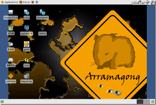
  • You should see the icons for the Geospatial applications on the desktop. You can start and try any application.
  • To save data, you'll need to apply for a free click2try account at http://www.click2try.com/component/user/?task=register.

About Arramagong

Arramagong is a self-contained live DVD and Virtual Machine, based on XUbuntu and GISVM, that allows you to try a wide variety of open source geospatial software without installing anything. It is composed entirely of free software, allowing it to be freely distributed, duplicated and passed around. A full list of installed packages is at: http://www.arramagong.com/Arramagong/contents.html

As explained by Cameron Shorter, coordinator of Arramagong and Geospatial Solutions Manager at LISAsoft,

"Arramagong allows users to easily try out the robust, feature rich stack of applications offered by Geospatial Open Source. It is a compelling marketing tool for us organisations who support Open Source."

About FOSS4G

http://2009.foss4g.org

FOSS4G is the international Free and Open Source Software for Geospatial conference, which comes to Sydney, Australia, 20-23 October 2009. FOSS4G offers presentations, workshops, demos, an install-fest, and a code sprint. It is presented by the world's best Developers, Policy Makers, Sponsors and Geospatial Professionals and includes the latest geospatial applications, standards, government programs, business processes and case studies. Topics include mobile platforms, location based applications, crowd sourcing, cloud computing, development, spatial standards, integration of cross-agency data, Spatial Data Infrastructures, Sensor Webs, Web Processing Services, Integration of Open Source and Proprietary Software and more.

About Click2Try

http://click2try.com/

click2try is an online Open Source application showroom that helps visitors easily evaluate and use Open Source Software from within their web browser. click2try employs a unique, advanced technology framework, built completely on Open Source software, to provide on-demand, multiuser, concurrent access to enterprise-level Open Source software applications.

Upcoming milestones

  • 20 Oct 2009, FOSS4G Workshop
  • 21-23 Oct 2009, FOSS4G Presentations and Tutorials
  • 24 Oct 2009, FOSS4G Code Sprint

Media Sponsors

Tuesday, 13 October 2009

7 Bridges Walk, after FOSS4G


Like to walk across seven of the grand Sydney bridges? On Sunday 25 October, after FOSS4G, there will be a 25km, city coordinated, 7 bridge walk. It will be a nice way to see the city (even if you only take on a few sections a catch a ferry back to the start). Details at: http://www.7bridgeswalk.com.au

Tall Ship sailing fun at FOSS4G


Want to sail Sydney Harbour in a tall ship and promote a safe climate at the same time? Then you will probably want a berth on this ship, sailing on Saturday 24 October, after the FOSS4G event. Details at http://ssec.org.au/350/
350 is the safe upper limit for carbon dioxide in our atmosphere. Published by leading scientists only last year, this target is already in the draft global climate treaty for negotiation at Copenhagen in December. But it’s just one option, along with other competing targets that we now know are dangerously weak.
On Saturday October 24th, people all around the world will be speaking with one voice. From the Great Barrier Reef to the Great Wall of China, at over 1500 events in 125 countries, the world will say: 350.
By cruising Sydney Harbour on the Southern Swan, you will help to make a powerful statement to the world’s leaders: we want a fair, ambitious and binding treaty that aims for success: restore a safe climate by bringing CO_2 back below 350.

Saturday, 3 October 2009

Arramgong GIS Live DVD - off to printers


After a hive of activity from a team of 20 or so people, we have a Geospatial Live DVD and Virtual Machine with a comprehensive collection of Open Source Geospatial Software. The Arramagong Live DVD was sent to the printers last week and will be handed out to all delegates at the international conference for Free and Open Source Software for GeoSpatial, http://2009.foss4g.org.
But probably more valuable than this specific release is the fact that we have automated the building of the LiveDVD so that anyone with a decent internet pipe can build themselves a customised GeoSpatial LiveDVD in 24 hours - a task that used to take months and was consequently a major development barrier.
As LISAsoft discovered when helping build the LiveDVD for FOSS4G 2008, there are a number of barriers to packaging. Ideally, all projects should package their applications in .deb files, aligned with DebianGIS and UbuntuGIS projects. Installing .deb files into a LiveDVD is as simple as:
apt-get install package.deb
However, there is a non-trivial learning curve for packaging applications for debian, and Java packaging is poorly supported, and there has been a knowledge gap between packagers, familiar with packaging, and developers familar with installing their specific application. So only a few of the popular GeoSpatial Open Source applications are easily installed on Linux. Most OSGeo applications need to be manually installed, and hence packaging for the FOSS4G 2008 LiveDVD and the GISVM involved dedicated developers putting in hero efforts to learn and apply the specific install instructions and dependencies for each project individually. It took months.
For FOSS4G 2009 we have been smarter. We asked projects to write a command line installer script for their packages, in line with a provided template. We then strung all the installers together in an automated master build process. This meant:
  1. An installer script is much easier to write than a .deb file, and hence we had many projects contribute.
  2. The automated build process meant we could release and test the Virtual Machines often, and involve the whole community in the testing cycle.
And as a by product, these scripts are the key element Debian packagers require to build .deb packages, so we should expect to see many of these projects appear in the next Debian and Ubuntu releases.
What next?
  1. Include install scripts for more applications
  2. Refine the user experience
  3. Align with OSGeo Education initiatives to provide training for each of the applications, via documentation, videos etc. and have this material included in the distribution.
  4. Target other media, like USB drives.
  5. Support targeted releases for specific purposes. (It is as simple as tweaking the install list if you want to create a targeted distribution).
  6. And I'm sure there are many other ideas. Tell us about them.
Credits
Many people worked very hard to get all these applications in place in such a short period of time. I'd like to thank you all for all the help. (I'd try and list you all, but I'm afraid I'd miss someone).

Friday, 2 October 2009

Australian Government initiative to set up an Open Technology Foundation

The South Australian Government, through the Office of the Chief Information Officer, have proposed to set up an "Open Technology Foundation" on behalf of Australian government which is:
  • a collaborative effort between governments, industry, academia, and communities of interest.
  • committed to the evaluation and where proven, uptake of open technologies, standards and methods.
  • exists to help governments make better, more cost effective and innovative use of open technologies in order to improve service delivery to citizens.
  • focused on openness in order to help agencies achieve more interoperability, independence, resilience and flexibility in their ICT operations.
They are currently looking for letters of support for their business plan before Wednesday 14 October 2009. An overview and webcast about the initiative can be found at http://www.cio.sa.gov.au/business/projects/open-technology-foundation .

Supporting governments embrace Open Technologies is an effective way to reduce government spending and I strongly support this.
In particular, Open Technologies facilitate cost savings by spreading development and maintenance costs between multiple agencies, both nationally and internationally. However, uptake of Open Technologies is often hindered by specific project purchasing guidelines which focus on immediate deliverables. People are not paid to spend the extra effort required to make an application easy to share. I suggest the business plan also focus on the development of purchasing guidelines which encourage Open Technologies and collaborative approaches.
Steve Schmid, the key person behind the initiative will be leading a FOSS4G in Government Birds of a Feather session at the FOSS4G conference in just over a week. Look out for him if you are going to the conference.

Wednesday, 23 September 2009

Rush on Geospatial Open Source Workshops at FOSS4G

Sydney, Australia. 23 September 2009. http://2009.foss4g.org

Many FOSS4G workshops are close to full, with one workshop already at capacity. http://2009.foss4g.org/workshops/ People wanting to learn about Geospatial Standards, Geospatial Open Source Software and Business Cases should sign up soon to avoid disappointment.

Also, in Open Source tradition, there is a breadth of other exciting activities to sign up for:

About FOSS4G

FOSS4G is the international Free and Open Source Software for Geospatial conference, which comes to Sydney, Australia, 20-23 October 2009. FOSS4G offers presentations, workshops, demos, an install-fest, and a code sprint. It is presented by the world's best Developers, Policy Makers, Sponsors and Geospatial Professionals and includes the latest geospatial applications, standards, government programs, business processes and case studies. Topics include mobile platforms, location based applications, crowd sourcing, cloud computing, development, spatial standards, integration of cross-agency data, Spatial Data Infrastructures, Sensor Webs, Web Processing Services, Integration of Open Source and Proprietary Software and more.

Media Sponsors


For more information or to keep informed from the FOSS4G Organising Committee, join our email list or twitter feed at: http://2009.foss4g.org/about_us/

Friday, 11 September 2009

Mark is trialling Sydney entertainment for us


One of the perks of running a conference is that you are occasionally given free tickets to shows, or harbour cruises or the like, in the hope that we might write a blog like this and tell all our international friends to go see the show.
So Mark Leslie, who has been flat out sorting out workshops and other things, has volunteered to check out the "Wicked" musical currently running in Sydney. Thanks Mark.

Sunday, 6 September 2009

What windows installers should be on the FOSS4G Live DVD?


Sydney, Australia. 6 September 2009. http://2009.foss4g.org

The Arramagong Live DVD / GISVM email list has been running hot last week, with ~ 15 people helping write install scripts for projects in order to meet our feature freeze deadline tomorrow, Monday 7 September.

The list of linux projects currently being packaged for the FOSS4G LiveDVD are:

PostGIS ,GeoServer ,Mapserver ,GRASS ,Qgis ,gvSIG ,uDig ,Open Layers ,GeoNetwork ,Open Jump ,Deegree ,GpsDrive ,mapnik ,MB System ,pgRouting ,52 North Sensor Observation Service ,Mapfish ,Marble.

Our next steps are:

  • Package up the windows installers for the Live DVD. Please tell us what installers are available, and where they are located, by updating the following ticket: http://trac.osgeo.org/osgeo/ticket/424
  • Write introductory documentation for all projects
  • Test the image and iron out any issues we find before users find them. (I'm hoping communities will step up and test their favourite applications starting next week.)
  • Plus lots of little things

Details for getting involved are at: http://wiki.osgeo.org/wiki/Live_GIS_Disc and we hang out at irc://freenode.net#foss4g

Live DVD Timeline

Date Date Milestone
7 Sep 2009 in 1 day LiveDVD Feature Freeze
11 Sep 2009 in 1 week LiveDVD Beta Release
18 Sep 2009 in 2 weeks LiveDVD Final Freeze
20 Sep 2009 in 2 weeks LiveDVD Final Release & sent to printers

About GISVM

GISVM is a Free(dom) and ready to use anywhere Geographic Information System Virtual Machine. Based on the amazing Virtualization technology it can be used on almost any operating system environment and is intended to be a hassle-free installation option for anyone that needs a ready to use GIS solution.

About Arramagong Live DVD

The Arramagong Live DVD provides a stack of most of best Geospatial Open Source software, pre-configured with sample data. It is based on the XUbuntu linux operating system and also contains windows installers. A FOSS4G 2009 release of Arramagong will be given to all delegates at the FOSS4G conference. It has been built by LISAsoft in conjunction with the Open Source Geospatial community.

About FOSS4G

FOSS4G is the international Free and Open Source Software for Geospatial conference, which comes to Sydney, Australia, 20-23 October 2009. FOSS4G offers presentations, workshops, demos, an install-fest, and a code sprint. It is presented by the world's best Developers, Policy Makers, Sponsors and Geospatial Professionals and includes the latest geospatial applications, standards, government programs, business processes and case studies. Topics include mobile platforms, location based applications, crowd sourcing, cloud computing, development, spatial standards, integration of cross-agency data, Spatial Data Infrastructures, Sensor Webs, Web Processing Services, Integration of Open Source and Proprietary Software and more.

Upcoming FOSS4G milestones

  • 14 Sep 2009, Final program available
  • 21 Sep 2009, Poster Submission closes
  • 20 Oct 2009, FOSS4G Workshop
  • 21-23 Oct 2009, FOSS4G Presentations and Tutorials
  • 24 Oct 2009, FOSS4G Code Sprint

Media Sponsors


For more information or to keep informed from the FOSS4G Organising Committee, join our email list or twitter feed at: http://2009.foss4g.org/about_us/

or contact:

Cameron Shorter, Chair of the FOSS4G Organising Committee and Geospatial Systems Architect at LISAsoft

tel +61-2-8570-5050

c a m e r o n . s h o r t e r @ l i s a s o f t . c o m

Friday, 4 September 2009

More about Australia's Digital Regions Initiative


I attended a briefing about Australia's Digitial Regions Initiative which is co-funding projects to help regional education, health, and disaster response projects. (previous description).
The key take home points for me were:
  • The Expression of Interest, due 14 September 2009, is aimed at identifying potential projects, and giving parties the opportunity to find each other and collaborate on the final proposal, to be lodged by 14 October.
  • I asked whether it was in scope to propose an Open Street Map style application, which facilitates community collection, cleaning, and collaboration around spatial and attribute data. This was certainly considered in scope, if the value to communities could be demonstrated. Value is based upon the number of people serviced, the value presented to each person, and whether the service is filling an existing gap.
  • The initiative is expecting to fund 50% of multi-million dollar projects. However, smaller projects will be considered, so long as they can demonstrate appropriate value. External funding sources (and I'm specifically thinking about co-funding with international government programs) would be acceptable.

Saturday, 29 August 2009

The Easy steps to get your project on the FOSS4G Live DVD


The Arramagong Live DVD, GISVM, and OSGeo Live-Demo projects are collaborating to create a set of simple, automated install scripts for a wide variety of Free and Open Source GIS projects, and we're calling on each project to help us write a script for their software. Projects that can write their install script this week will be included on The Arramamgong Live DVD which will be given to all delegates at the FOSS4G conference.
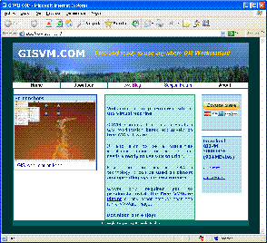
The scripts should cover the installation and configuration of each project into a base Xubuntu 9.04 system. Separate scripts can optionally cover data, demos and tutorials. As a bonus, these scripts are exactly what packagers require to bundle your project into Debian and Ubuntu, so you will be taking the first steps toward getting your project into a Linux distribution.

The base version of the FOSS4G2009 GISVM/Arramagong Live DVD can be trialled as a VMWare virtual machine and downloaded from: http://download.osgeo.org/livedvd/Arramagong_GISVM_FOSS4G2009_alpha1.7z

Timeline

Date Date Milestone
7 Sep 2009 in 1 week LiveDVD Feature Freeze
11 Sep 2009 in 2 weeks LiveDVD Beta Release
18 Sep 2009 in 3 weeks LiveDVD Final Freeze
20 Sep 2009 in 3 weeks LiveDVD Final Release & sent to printers

Packaging Howto

For projects already packaged for Ubuntu or DebianGIS, an install script will likely be as simple as:

install_mapserver.sh

#!/bin/sh
apt-get install cgi-mapserver


Projects that haven't been packaged yet are slightly more complicated:

install_udig.sh

#!/bin/sh
#################################################
#
# Purpose: Installation of udig into Xubuntu
# Author: Stefan Hansen
#
#################################################
# Copyright (c) 2009 Open Geospatial Foundation
# Copyright (c) 2009 LISAsoft
#
# Licensed under the GNU LGPL.
#
# This library is free software; you can redistribute it and/or modify it
# under the terms of the GNU Lesser General Public License as published
# by the Free Software Foundation, either version 2.1 of the License,
# or any later version. This library is distributed in the hope that
# it will be useful, but WITHOUT ANY WARRANTY, without even the implied
# warranty of MERCHANTABILITY or FITNESS FOR A PARTICULAR PURPOSE.
# See the GNU Lesser General Public License for more details, either
# in the "LICENSE.LGPL.txt" file distributed with this software or at
# web page "http://www.fsf.org/licenses/lgpl.html".
#

# About:
# =====
# This script will install udig into Xubuntu

# Running:
# =======
# sudo ./install_udig.sh

TMP="/tmp/udig_downloads"
INSTALL_FOLDER="/usr/lib"
DATA_FOLDER="/usr/local/share"
UDIG_FOLDER="$INSTALL_FOLDER/udig"
BIN="/usr/bin"
USER_NAME="user"
USER_HOME="/home/$USER_NAME"

## Setup things... ##

# check required tools are installed
if [ ! -x "`which wget`" ] ; then
echo "ERROR: wget is required, please install it and try again"
exit 1
fi
# create tmp folders
mkdir $TMP
cd $TMP


## Install Application ##

# get udig
if [ -f "udig-1.2-M6.linux.gtk.x86.tar.gz" ]
then
echo "udig-1.2-M6.linux.gtk.x86.tar.gz has already been downloaded."
else
wget http://udig.refractions.net/files/downloads/branches/udig-1.2-M6.linux.gtk.x86.tar.gz
fi
# unpack it and copy it to /usr/lib
tar -xzf udig-1.2-M6.linux.gtk.x86.tar.gz -C $INSTALL_FOLDER


## Configure Application ##

# Download modified startup script for udig
if [ -f "udig.sh" ]
then
echo "udig.sh has already been downloaded."
else
wget https://svn.osgeo.org/osgeo/livedvd/gisvm/trunk/udig-conf/udig.sh
fi
# copy it into the udig folder
cp udig.sh $UDIG_FOLDER

# create link to startup script
ln -s $UDIG_FOLDER/udig.sh $BIN/udig

# Download desktop icon
if [ -f "uDig.desktop" ]
then
echo "uDig.desktop has already been downloaded."
else
wget https://svn.osgeo.org/osgeo/livedvd/gisvm/trunk/udig-conf/uDig.desktop
fi
# copy it into the udig folder
cp uDig.desktop $USER_HOME/Desktop
chown $USER_NAME:$USER_NAME $USER_HOME/Desktop/uDig.desktop


## Sample Data ##

# Download udig's sample data
if [ -f "data-v1_1.zip" ]
then
echo "data-v1_1.zip has already been downloaded."
else
wget http://udig.refractions.net/docs/data-v1_1.zip
fi
#unzip the file into /usr/local/share/udig-data
mkdir $DATA_FOLDER/udig-data
unzip data-v1_1.zip -d $DATA_FOLDER/udig-data


## Documentation ##

# Download udig's documentation
if [ -f "udig-1.2-M5.html" ]
then
echo "udig-1.2-M5.html has already been downloaded."
else
wget http://udig.refractions.net/files/downloads/branches/udig-1.2-M5.html
fi

if [ -f "uDigWalkthrough1.pdf" ]
then
echo "uDigWalkthrough1.pdf has already been downloaded."
else
wget http://udig.refractions.net/docs/uDigWalkthrough1.pdf
fi

if [ -f "uDigWalkthrough2.pdf" ]
then
echo "uDigWalkthrough2.pdf has already been downloaded."
else
wget http://udig.refractions.net/docs/uDigWalkthrough2.pdf
fi

#copy into /usr/local/share/udig-docs
mkdir $DATA_FOLDER/udig-docs
cp udig-1.2-M5.html $DATA_FOLDER/udig-docs
cp uDigWalkthrough1.pdf $DATA_FOLDER/udig-docs


As we are still bootstrapping the packaging project, and as we are very short on time before feature freeze, manual steps can be included as comments in each install script, and can be automated by a project member, or packager at a later date.

Packaging details and examples can be found at: http://wiki.osgeo.org/wiki/GISVM_Build

And help is available on the Live-Demo mailing list via Cameron Shorter, Stefan Hansen, Ricardo Pino, Hamish Bowman, Alex Mandel, Massimo de Stefano and others.

About GISVM

GISVM is a Free(dom) and ready to use anywhere Geographic Information System Virtual Machine. Based on the amazing Virtualization technology it can be used on almost any operating system environment and is intended to be a hassle-free installation option for anyone that needs a ready to use GIS solution.

About Arramagong Live DVD

The Arramagong Live DVD provides a stack of most of best Geospatial Open Source software, pre-configured with sample data. It is based on the XUbuntu linux operating system and also contains windows installers. A FOSS4G 2009 release of Arramagong will be given to all delegates at the FOSS4G conference. It has been built by LISAsoft in conjunction with the Open Source Geospatial community.

About FOSS4G

FOSS4G is the international Free and Open Source Software for Geospatial conference, which comes to Sydney, Australia, 20-23 October 2009. FOSS4G offers presentations, workshops, demos, an install-fest, and a code sprint. It is presented by the world's best Developers, Policy Makers, Sponsors and Geospatial Professionals and includes the latest geospatial applications, standards, government programs, business processes and case studies. Topics include mobile platforms, location based applications, crowd sourcing, cloud computing, development, spatial standards, integration of cross-agency data, Spatial Data Infrastructures, Sensor Webs, Web Processing Services, Integration of Open Source and Proprietary Software and more.

Upcoming milestones

  • 14 Sep 2009, Final program available
  • 21 Sep 2009, Poster Submission closes
  • 20 Oct 2009, FOSS4G Workshop
  • 21-23 Oct 2009, FOSS4G Presentations and Tutorials
  • 24 Oct 2009, FOSS4G Code Sprint

Media Sponsors


For more information or to keep informed from the FOSS4G Organising Committee, join our email list or twitter feed at: http://2009.foss4g.org/about_us/

or contact:

Cameron Shorter, Chair of the FOSS4G Organising Committee and Geospatial Systems Architect at LISAsoft

tel +61-2-8570-5050

c a m e r o n . s h o r t e r @ l i s a s o f t . c o m

Wednesday, 26 August 2009

Digital Regions Initiative - Australian Government funding opportunities

The Australian Department of Broadband, Communications and the Digital Economy is offering to co-fund government programs under its Digital Regions Initiative.
Among other things, this would be an idea way to fund projects which support crowd sourcing of map features to efficiently support emergency and disaster response targets.
Quoting from the EOI:
The Digital Regions Initiative will support projects which will deliver innovative and sustainable services such as those that will:
  • boost innovation in healthcare by enabling services such as remote consultation, diagnosis and treatment in areas where there are specialist skills shortages
  • extend digital education services to enable more regional, rural and remote communities to access improved educational opportunities
  • increase the use of digital technologies to improve emergency and disaster response both within and across state and territory borders.
LISAsoft would be happy to help government agencies on a technical level in putting together a response for the EOI, due 14 September.

Saturday, 22 August 2009

FOSS4G conference: Draft program available


Sydney, Australia. 22 August 2009. http://2009.foss4g.org

An early draft of the FOSS4G program has been released in response to some delegates wishing to book flights and accommodation early. While there may still be some minor changes to the program, we are not anticipating many presentations to move from one day to another.

Details at: http://2009.foss4g.org/schedule/

Sunday, 16 August 2009

OSGeo Friendly countries to live in

Yves Jacolin has sliced FOSS4G website hits to determine the number of FOSS4G attendees per million people, broken down by country. From this, you can get a feeling for the most OSGeo tolerant populations in the world (distorted around Australia due to the conference location).
So what can we learn?
  • Japan and Mongolia are the place be in Asia
  • Chile is the place to be in Latin America
  • Canada looks preferable to the US. I wonder how much the Canadian GeoConnections program is responsible for Canada's strong OSGeo industry.
  • There is a lot of interest across Europe, so FOSS4G 2010 should be a crowded event.
  • Africa seems to have learned all they need to know when FOSS4G attended Cape Town last year, and won't be heading to Australia in force.


Friday, 14 August 2009

Sign up for FOSS4G bonus activities


Sydney, Australia. 14 August 2009. http://2009.foss4g.org

The FOSS4G conference is famous for its community driven, extra-curricular activities and wiki pages are now open for community members to define these activities for 2009. So if you want to get more out of FOSS4G than just listening, if you have a topic you want to discuss, a message you want to share, a product you want to show off or you want to network with like minded people, then please consider adding your name to one of the following activities.

Birds of a Feather

Semi-organised meetings between people with specific shared interests. If you have a discussion topic or project in mind and want to coordinate a BoF session, please add it to our working list. http://wiki.osgeo.org/wiki/FOSS4G_2009_BirdsOfAFeather

OSGeo AGM

OSGeo's Annual General Meeting which will hear reports from Local Chapters and OSGeo Committees. http://wiki.osgeo.org/wiki/Annual_General_Meeting_2009

Installfest

At the start of the conference, community members will be helping delegates install a wide variety of FOSS software on delegates laptops. Add the name of your project and yourself to the wiki if you will be attending. See also the Live DVD. http://wiki.osgeo.org/wiki/FOSS4G_2009_InstallFest

Posters

Limited poster boards will be on hand for the duration of the conference. Add your proposed project and contact details to the wiki so we can determine how big posters should be, and how many we can accept. Monitor poster discussion on the foss4g email list. http://wiki.osgeo.org/wiki/FOSS4G_2009_Posters

Demo Theater

Ten minute product presentation slots will be running during morning tea and lunch breaks. These presentations are being offered first to sponsors, then to community members. Contact the coordinators if you wish to be involved. http://wiki.osgeo.org/wiki/FOSS4G_2009_Demonstration_Theatre

Live DVD

A Linux based Live DVD, with windows installers, will be provided to all delegates. This disk will further be available for use at conferences and marketing events around the world long after FOSS4G. This is a huge marketing opportunity, but is currently under-resourced; there is a chance we will be left using the same DVD produced for the 2008 conference. If you are a good community organisor, or a wiz technical geek, please help out with this activity. http://wiki.osgeo.org/wiki/FOSS4G_2009_Live_DVD

Code Sprint

Saturday after FOSS4G: Passionate programmers + pizza + caffeine + whiteboards + wireless = great software advancements. Add a project you wish to work on, a coordinator, and goals for your code sprint. http://wiki.osgeo.org/wiki/FOSS4G_2009_Code_Sprint

The Climate Change Integration Plugfest (CCIP)

A demonstration of standards based interoperability between Open Source and Proprietary geospatial applications based on a Climate Change Scenario, being coordinated by the OGC. Contact Raj Singh if interested. http://external.opengis.org/twiki_public/bin/view/ClimateChallenge2009/WebHome

Volunteers

Want to help out with all the extra little jobs, or need volunteers for specific activities? http://wiki.osgeo.org/wiki/FOSS4G_2009_Volunteers

About FOSS4G

The Free and Open Source Software for Geospatial (FOSS4G) conference, coming to Sydney, Australia, 20-23 October 2009, attracts presentations from the world's best Developers, Policy Makers, Sponsors and Geospatial Professionals in the area of geospatial applications, standards, government programs, business processes and case studies. Topics include mobile platforms, location based applications, crowd sourcing, cloud computing, development, spatial standards, integration of cross-agency data, Spatial Data Infrastructures, Sensor Webs, Web Processing Services, Integration of Open Source and Proprietary Software and more.

http://2009.foss4g.org

Upcoming milestones

  • 14 Sep 2009, Completed program available
  • 20 Oct 2009, FOSS4G Workshop
  • 21-23 Oct 2009, FOSS4G Presentations and Tutorials
  • 24 Oct 2009, FOSS4G Code Sprint

Media Sponsors


For more information or to keep informed from the FOSS4G Organising Committee, join our email list or twitter feed at: http://2009.foss4g.org/about_us/

or contact:

Cameron Shorter, Chair of the FOSS4G Organising Committee and Geospatial Systems Architect at LISAsoft

tel +61-2-8570-5050

c a m e r o n . s h o r t e r @ l i s a s o f t . c o m

Thursday, 13 August 2009

Australian Gov 2.0 roadshow


In line with initiatives from other nations, the Australian government is investigating how to:
  • make government information more accessible and usable — to establish a pro-disclosure culture around non-sensitive public sector information;
  • make government more consultative, participatory and transparent — to maximise the extent to which government utilises the views, knowledge and resources of the general community;
  • build a culture of online innovation within Government — to ensure that government is receptive to the possibilities created by new collaborative technologies and uses them to advance its ambition to continually improve the way it operates;
  • promote collaboration across agencies with respect to online and information initiatives — to ensure that efficiencies, innovations, knowledge and enthusiasm are shared on a platform of open standards; and
  • identify and/or trial initiatives that may achieve or demonstrate how to accomplish the above objectives.
The Gov 2.0 taskforce are calling for comments on their issues paper at: http://gov2.net.au/blog/2009/07/18/help-us-finalise-our-issues-paper/ and will be on a roadshow around Australian capital cities over the next few weeks. Details at: http://gov2.net.au/roadshows/

Friday, 7 August 2009

$180 million dedicated to the Australian Coorperative Research Center for Spatial Information

PRESS RELEASE

Key Australian industries will gain access to new data, technologies and services through the funding of a major research program in spatial technologies, announced by Senator Kim Carr today.

With a total budget of $180 million, the new Cooperative Research Centre for Spatial Information (CRCSI-2) involves over 100 organisations including from government and the private sector coming together with universities in an eight-year joint venture.

“The new CRC SI will help us to remain internationally competitive and capitalise on rapid growth in the spatial industry. The CRC Program’s investment in this industry will deliver tremendous benefits to the nation.” Said Mary O’Kane, Chair-elect of the CRCSI-2 Board.

“Through this funding the CRC Program has recognised the tremendous potential spatial information offers to the Australian economy,” said CEO Dr Peter Woodgate.

The spatial information industry currently contributes an estimated $12.6 billion to national GDP. Direct outcomes from the CRCSI-2 are expected to deliver a further $305 million to the nation if emerging developments can be leveraged for Australian industry. The wider benefits are far larger.

Over 90 end-users, mostly small and medium companies, will participate in the program to direct and speed delivery of research outcomes.

“Our end-users give us a tremendously strong picture of the technology and services the marketplace needs,” said Dr Woodgate.

The CRCSI will deliver benefits to several industry sectors including:

  • Health – Preventative medicine policies will be improved through the way in which spatial information can show patterns of disease which are otherwise undetectable. CRCSI-2 will spatially analyse data for early detection of colo-rectal cancer and childhood leukaemia.
  • Energy and utilities – Unmanned air craft will monitor powerlines with laser scanners to get timely, accurate knowledge on the condition of power infrastructure which will improve safety and reduce costs for consumers.
  • Sustainable urban development – Planning, transport costs and “living affordability” in our cities and towns will be assisted by spatially understanding what makes good urban areas work.
  • Agriculture and climate change – Farmers will have more precise information to guide the planting, treatment and harvesting of crops due to spatial precision agriculture. Scientists and land managers will be able to monitor landscape changes more closely, particularly important given the widespread effects anticipated from climate change.
  • Defence – research into new imaging technologies for national defence

Though its strong international linkages, the CRCSI-2 will also be targeting overseas markets to deliver new technologies and services.

“Our fledgling industry will have a great chance to gain international prominence through this initiative,” said David Hocking, CEO of the Spatial Industries Business Association which is also participating in the CRCSI-2.

“Overseas governments are spending big on infrastructure and that is where our 500 members operate.”

“In its first incarnation, the CRCSI helped to position Australia as a world leader in the development and use of spatial information technologies,” according to Warwick Watkins, Chairman of the Australia and New Zealand Land Information Council.

Background

Spatial Information is at the core of a number of platform technologies and services, from traditional surveying to contemporary technologies like GPS and location-based services. It describes the location of objects in the real world and the relationships between objects. Practical applications include environmental monitoring, GPS services, customer relationship management and the management of natural resources, biosecurity, assets, land and emergencies. The spatial information industry contributes up to $12.6 billion to Australia’s Gross Domestic Product.

For more information visit www.crcsi2.com.au

Saturday, 18 July 2009

Feed a Geek


It has been a pleasure to have Justin Deoliveira from OpenGeo camped out in LISAsoft offices for the last week. He is a lovely person, and really knows his stuff. On top of the pure friendship factor, I've been able to work up a business case for feeding housing him and his laptop and take him out to lunch, based on the amount of high quality information I soak up in conversation.
Justin seems to be living the often talked about, but rarely seen, life of a programmer working on amazing technology while he is globe trotting around the world. I watched with envy, then took him out to lunch with LISAsoft management, and asked Justin about how well it worked for him. (I wanted my management to hear the answer.)

Saturday, 4 July 2009

Who's interested in FOSS4G?

Running a conference like FOSS4G is a nail biting exercise. The large fixed expenses (like conference venue) are committed up front when you only have wild guesses as to how many delegates are likely to come, and you don't get a reasonable understanding for the number of delegates till just before the conference starts when everyone files their last minute registration. It is much easier writing software, where there are established, linear metrics for tracking progress.
Even so, there are few indicative metrics which give us tentatively positive feeling about the interest in the FOSS4G conference.
We have been using Google Analytics to track who has been coming to our website and a few take home messages are coming out:
  • People from all around the world are interested in FOSS4G.
  • As hoped, we have positive interest locally from Australia.
  • Compared to previous years, we are getting a strong showing from the Asia/Pacific region. This should vindicate OSGeo's actions of moving the conference around the world, so that is local to everyone at some point.
  • As has traditionally been the case, there is strong interest from Europe, Canada, and the US. I'm hopeful that this interest, along with Australia's reputation as a holiday destination, will attract delegates.
If you want to see these metrics in more detail, or use the metrics as the basis for one of your presentations at FOSS4G, then you can have a look for yourself at:
http://www.google.com/analytics/
Log in with username:foss4g2, password:foss4g2009.

Reminder: Early Bird registration for FOSS4G, closes in less than two weeks on 7 August 2009, so make sure you register now.

Thursday, 25 June 2009

Moves to free Australian Public Sector Information


The Victorian Parliament’s Economic Development and Infrastructure Committee (“EDIC”) has released a report recommending the freeing of access to Public Sector Information. Bruce Bannerman and I tabled an OSGeo submission for this report, as did a number of other enlightened organisations.
Anne Fitzgerald summarises the situation well, (note that Anne has submitted an abstract about Open Data for the FOSS4G conference):
I, Brian Fitzgerald and other research collaborators (including those working within the Queensland Treasury’s Office of Economic and Statistical Research) made verbal and written submissions, which are extensively referred to with approval by the committee throughout its report. This is a very important report, as it is the first in Australia to consider in depth the issue of access to Public Sector Information, and is likely to provide the template for work by the Federal and other [Australian] State/Territory governments. The report recommends that the Victorian Government should establish an Information Management Framework, with open access to Government information at no or marginal cost as the default position.
Donna Benjamin noted on the Open Source Industries Australia email list some of the Open Source highlights:
Recommendation 42: That the Victorian Government require, as part of its whole-of-government ICT Procurement Policy, that software procured by the Government be capable of saving files in open standard formats, and that wherever possible, the software be configured to save in open standard formats by default.

Recommendation 43: That the Victorian Government ensure when preparing guidance for procurement, ICT personnel should be equally aware of the strengths and weaknesses of both OSS and proprietary software.

Recommendation 44: That the Victorian Government fully evaluate the Victorian Department of Justice open source software (OSS) workstation trial to assess the potential for wider use of OSS in Victorian public service workstations.

Recommendation 45: That the Victorian Government examine its policy for ICT Procurement to ensure that it continues to assist the Victorian ICT industry.

Recommendation 46: That the Victorian Government ensure where appropriate that tenders are neither licence specific nor have proprietary software-specific requirements; and meet the given objectives of Government.

For further information, read the press release at: http://www.parliament.vic.gov.au/edic/inquiries/access_to_PSI/PSI_Inquiry_Media_Release.pdf
The report itself is at http://www.parliament.vic.gov.au/edic/inquiries/access_to_PSI/final_report.html

OSGeo at Spatial@Gov conference, Canberra, Australia


The Aust-NZ OSGeo local chapter set up and OSGeo booth at the Spatial@Gov conference a few days back, and I gave a well attended Geospatial Open Source presentation. The conference attracted ~ 200 delegates and covered:
The conference was particularly encouraging for people interested in "Open Technologies". It was opened by Senator Kate Lundy, who is making a name for herself in Australia around Open Government (and who is also a keynote speaker at the FOSS4G conference in October). Then most of the presentations I attended mentioned Open Standards. In particular, there is a strong push to develop a "Spatial Marketplace" which is effectively a Spatial Data Infrastructure. I was pleasantly surprised to hear ~ 30% of the presentations mention how agencies are deploying Open Source software. And there was regular mention about how agencies are following Queensland's initiatives moving government data to Creative Commons licenses. (There are abstracts on this at FOSS4G too).
Thanks to the following people for helping to man the OSGeo stand:
  • Milton Lofberg & Autodesk for sponsoring the booth
  • Cameron Shorter (me) and LISAsoft for providing fliers and giving an Open Source presentation
  • Bruce Bannerman
  • Shoaib Burq
  • Plus a couple of others who dropped by for a bit