Saturday 26 November 2016

The elusive "Open Business"


Variants presented at:
  • The “Geo-enabling our communities” conference, hosted by the Australian/New Zealand Surveying & Spatial Sciences Institute, Canberra, Australia, 25 November 2016.
  • The International Digital Earth Symposium, Sydney, Australia, 6 April 2017.
  • The "Spatial Information Day" conference, Adelaide, Australia, 11 August 2017.
  • Slides available at: https://docs.google.com/presentation/d/19fwg23g86PKNNuVlH8BmcWRnA9nwL_tgowJOoFPOLdc/edit?usp=sharing 


The Open Source story about creating Free Software sounds a bit like a fairy tale. 
Highly motivated developers, 
joyfully beaver away, 
in the middle of the night,
to create high quality software systems,
which they give away for free.
While this simplistic recount is mostly true, 
it glosses over the many subtle details required to create a successful Open Source project. 

Why do so many people give away so much of their time?
Why are these volunteers so effective?
Why does open source work?
Why has the business world found the open source formula so hard to replicate?

Surprisingly, many of the answers are found of our core morals and ethics.

The question of Open verses Proprietary actually breaks down into a series of sub questions.
  1. Should you use Free Software or Free Data?
  2. Should you design systems using Open Architectures and Open Standards?
  3. Does it make sense to contribute back to communities?
  4. Is there a business case to help lead community initiatives?
  5. And if so, should you help scale community and tap into the world’s collective intelligence?

This is a big topic and we have limited time, so I will focus on some of the key messages, mostly at the “use and implement” end of the continuum.

Lets start by asking why you might use Open Source GIS Software?
If you are starting from scratch, the answer is simple. 
There is a comprehensive stack of mature, widely used and widely supported Open Source Geospatial applications, all available for free.
This is a screenshot from the OSGeo-Live software distribution. 
OSGeo-Live includes 50 of the best geospatial Open Source applications, along with sample data, project overviews, and quickstarts for each application.
Lets look at a few of the more popular applications:

QGIS is a desktop GIS application similar to ArcGIS with comparable features, but it free.

OpenLayers is similar to Google Maps API, or ESRI’s Javascript APIs, also free.

Cesium provides a 3 dimensional globe of the earth, like Google Earth, but free.

GeoServer is a map rendering server, similar to ArcGIS Server.
It is the reference implementation for a number of the OGC standards, and is … free.

PostGIS adds spatial functionality to the Postgres database.
It is comparable in maturity, stability, performance and features to Oracle Spatial and Microsoft SQL Server, except it is … free.

For free data, you can use Open Street Map, and Open Route Map. This data is typically pretty good, and suitable for most use cases, but still not as consistent as datasets such as Google Maps.

Ok, so the software and data can be free, but there is more to applications than just the purchase price.
There is deployment, maintenance, training, support.
And who are you going to call at 2am in the morning if something goes wrong?

And that is where companies like Jirotech, EnterpriseDB and Redhat step in.
They backfill the capabilities of organisations deploying these free applications with enterprise level support and services.

So we have covered the first obvious question, 
“Does open source compete favourably feature-for-feature?” It does.
But we have just started. When considering an organisations’ technical roadmap, there are more reasons for selecting Open strategies.
Lets start by considering some of the characteristics of the digital age.

And the amount of software created is innovating at a similar rate.

Odds are that any software you own will be out-innovated within a year or two.
Your software is not an asset!
Your software is a liability!
It needs to be updated, maintained, and integrated with new systems.
It is technical debt, and you should try to own as little of it as possible.
You can achieve this by purchasing Proprietary Software, by using Software as a Service, or by leveraging Open Source.

Because software is so time consuming to create and so easy to copy, it is excessively prone to monopolies.
This holds true for both proprietary and open source products. A product that becomes a little better than its competitors will attracts users, developers and sponsors, which in turn allows that product to grow and improve quickly, allowing it to attract more users. This highly sensitive, positive feedback leads to successful software projects becoming category killers.
Where Open Source and Proprietary business models differ is how they respond to monopolies. 
Proprietary companies are incentivised to lock out competition and increase prices as much as the market will bear. 
However, the open source licenses are structured such that multiple companies can support the same open source product, so the market self corrects any tendencies toward price-fixing.

This leads us to Vendor Lock-In. 
Vendor Lock-In occurs when replacing a vendor’s product would significantly impacts your business.
It is a significant risk, as vendors then have excessive influence on price and your future technical design options.
There are two key strategies to mitigate against vendor lock-in.
  1. Is to use open source, as multiple vendors can all support the same codebase.
  2. Is to design modular architectures based on open standards. 

Using modular architectures:
  • reduces system complexity,
  • which reduces technical risk,
  • and facilitates sustained innovation.

It means you can improve one module, without impacting the rest of your system.
This helps with maintenance, innovation, and keeping up with latest technologies.

Committing to and sustaining a modular architectures requires continual vigilance and forward thinking, especially when acquiring new systems.
There will always be quick fixes and vendors offering more features if you are prepared to accept a level of lock-in.
You should be considering:
  • Long term maintenance,
  • Ability to integrate with other systems, 
  • Obsolescence,
  • And the cost of a future exit strategy. 


What I’ve described so far is practical, main stream advice.
Using open standards, open source and open data is now promoted in government policies and purchasing guidelines, and can be justified based on sound traditional economics.
But the Open Source culture is not based on traditional economics.

Open Source and Open Data communities are usually founded on gift cultures, and continue to retain the principles of the gift culture in their DNA. 
If you wish to successfully engage with these open communities, 
If you wish to have these communities adopt and maintain your codebase,
It helps to understand and respect these gift cultures.
And this starts by understanding our human desires to do things intrinsically good and valuable.

Which brings us to the topic of motivation. While traditional carrot and stick incentives improve motivation for boring, mechanical type tasks, research has shown it to be counter-productive for higher order thinking, such as creating software.
Dan Pink has collated this motivational research into a compelling book called Drive where
he describes how we humans are wired with deeper and more effective motivations. Namely: …

Autonomy, the desire to be self directed.

Mastery, the urge to get better at stuff.

And purpose, the desire to do something with meaning and importance.
So if we facilitate the collaboration of highly motivated people, with the interconnectedness of the internet, and provide them with creative tools, amazing things happen.

Like:
  • Wikipedia which has displaced Encyclopedia Britannica as the authoritative information source,
  • And Linux which is the dominant operating system in IT service centres,
  • Open Street Map, which provides detailed maps of the entire world,
  • And the OSGeo-Live distribution of Open Source Geospatial Software, a project I’ve been involved in for close to 10 years and which has attracted hundreds of contributors.

So how does this translate to attracting and engaging communities?
Professor Charles Schweik tackled this question. He and his team studied thousands of Open Source projects to identify common characteristics of successful projects, and they came up with some interesting findings. Like:
  • Most successful open source projects are small, with just 1, 2 or 3 developers. This is surprising if your exposure to Open Source is through the media stories which almost exclusively reference large projects such as Linux or Android.
  • Also, most open source projects are abandoned. 5 out of 6 according to Charle's research. 

But this is not a weakness, the low success rate is actually a good thing.
Developers vote with their time, and only great projects survive.

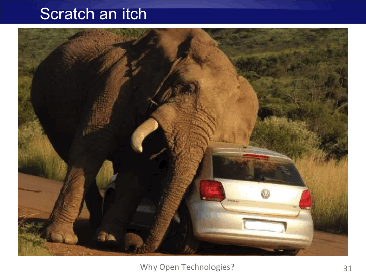
Also, when your developers are also users, wanting to scratch an itch, they are the best qualified to decide what is best for a project.

And when your developers are motivated by Autonomy, Mastery and Purpose, they will be motivated to spend extra time to “Get things right” rather than compromise on quality.


What Charlie's team found from their research was that successful projects usually possess:
  • A clearly defined vision,
  • Clear utility,
  • And leaders who lead by doing.
Then as projects move into a growth phase, successful projects tend to:
  • Attract an active community.
  • Provide fine scaled task granularity, making it easier for people to contribute.
  • And often benefit from attracting financial backing.
Lets expand on this. What attracts community?

Attracting volunteers involves helping maximise the unique, intrinsic value a person can contribute based on their limited time available.
Effectively maximise the usefulness and moral return on effort.

This starts with a clear and compelling vision, inspiring enough that others want to adopt the vision and work to make it happen.
This should be followed by a practical and believable commitment to deliver on the vision. Typically this is demonstrated by delivering a “Minimum Viable Product”. 

Then you need to be in need of help, preferably accepting small modular tasks with a low barrier to entry, and ideally something which each person is uniquely qualified to provide.
If anyone could fix a widget, then maybe someone else will do it. But if you are one of a few people with the skills to do the fixing, then your gift of fixing is so much more valuable, and there is a stronger moral obligation for you to step up.

Attracting collaborators means new ideas, new ideologies, and new visions.
A successful project works out how to balance competing priorities of adding features, retaining quality, remaining sustainable, and staying on task.

As projects mature and increase in complexity, reliance on the experience of core contributors increases.
Eventually core tasks for large projects usually becomes more consuming than can be sustained by volunteers.
At this point, sponsorship really helps.

As an example, I’ll reference the OSGeo-Live project I’ve been involved in.
Ten years ago, the Open Source Geospatial Foundation was a collection of Open Source applications, but lacked consistent marketing and was difficult for new users to navigate and understand. 
So we proposed to package all the applications on a DVD, ready to run, with sample datasets and consistent documentation. This was our vision.
We then created a minimal first version of the distribution, demonstrating our commitment
As some of us were on the organising committee of the next international geospatial Open Source Conference, we committed to hand out the DVD at the conference, creating a targeted marketing pipeline. This provided clear value for the developers we were recruiting. 
Then we provided simple guides on how to write installers and documentation and went to the open source developers saying:
“If you package your application and write documentation, like this…, then you can tap into a targeted marketing pipeline”. This made it easy for developers to provide discrete and uniquely valuable contributions. 
And it worked. We have attracted 100s of volunteers, to package 50+ projects, with documentation translated into over 10 languages, which is updated every 6 months.

Ok, so maybe you might be thinking that giving back to open communities might be noble, worthy, the right thing to do.
But there is no way you’d be able to justify it to management. You wouldn’t be the first to face this dilemma. We regularly help organisations answer various permutations to this question.
The answer typically references “Opportunity Management”.
Opportunity Management is the reverse of Risk Management. However, instead of identifying what could go wrong and putting strategies in place to prevent it, you identify things that could go right, then put strategies in place to help make it happen.
Help an open source community, and the number of users, developer and sponsors will grow, and you will indirectly reap the benefits.

So what have we covered?
  • Software is a liability.
  • Minimise your technical debt.
  • Design modular architectures with Open Standards. 
  • It reduces vendor lock-in, increases maintainability, agility and ability to innovate.
  • There is a breadth of Open Source applications which are feature rich, mature and commercially supported.
  • And there is Open Data available to address many of your use cases.


To take things to the next level, to engage with Open Source communities and tap into their collective creativity, you should re-learn how gift cultures work.
The beautiful part to this is that it involves reconnecting with our inner morals and ethics, and doing the right thing.


Tuesday 9 August 2016

OSGeo-Live 10.0 Released


Version 10.0 of the OSGeo-Live GIS software collection has been released, ready for the FOSS4G conference in Bonn, Germany - the annual global event of the Open Source Geospatial Foundation (OSGeo).

Release Highlights 

Lubuntu 16.04 LTS
    OSGeo-Live has been upgraded to the latest Lubnutu 16.04 Long Term Support (LTS) release

Applications
    PyWPS now included
    32 applications updated to newer versions, including major updates of:

  • Mapnik from 2.3.0 to 3.0.11
  • GDAL from 1.11.3 to 2.1.0

About OSGeo-Live

OSGeo-Live is a self-contained bootable DVD, USB flash drive and Virtual Machine, pre-installed with robust open source geospatial software, which can be trialled without installing anything. It includes:

  • Over 50 quality geospatial Open Source applications installed and pre-configured
  • Free world maps and sample datasets
  • Project Overview and step-by-step Quickstart for each application
  • Lightning presentation of all applications, along with speaker's script
  • Translations to multiple languages

Homepage: http://live.osgeo.org

Download details: http://live.osgeo.org/en/download.html

Credits

Over 180 people have directly helped with OSGeo-Live packaging, documenting and translating, and thousands have been involved in building the packaged software.

Developers, packagers, documenters and translators include:

Activity Workshop, Alan Boudreault, Alex Mandel, Alexandre Dube, Amy Gao, Andrea Antonello, Angelos Tzotsos, Anton Patrushev, Antonio Santiago, Argyros Argyridis, Ariel Núñez, Astrid Emde, Balasubramaniam Natarajan, Barry Rowlingson, Benjamin Pross, Brian Hamlin, Bruno Binet, Bu Kun, Cameron Shorter, Dane Springmeyer, Daniel Kastl, Danilo Bretschneider, Dimitar Misev, Edgar Soldin, Eike Hinderk Jürrens, Eric Lemoine, Erika Pillu, Etienne Dube, Fabian Schindler, Fran Boon, Frank Gasdorf, Frank Warmerdam, François Prunayre, Friedjoff Trautwein, Gabriele Prestifilippo, Gavin Treadgold, Gerald Fenoy, Guillaume Pasero, Guy Griffiths, Hamish Bowman, Haruyuki Seki, Henry Addo, Hernan Olivera, Howard Butler, Ian Edwards, Ian Turton, Jackie Ng, Jan Drewnak, Jane Lewis, Javier Rodrigo, Jim Klassen, Jinsongdi Yu, Alan Beccati, Jody Garnett, Johan Van de Wauw, John Bryant, Jorge Sanz, José Vicente Higón, Judit Mays, Klokan Petr Pridal, Kristof Lange, Lance McKee, Larry Shaffer, Luca Delucchi, Mage Whopper, Marc-André Barbeau, Manuel Grizonnet, Margherita Di Leo, Mario Carrera, Mark Leslie, Markus Neteler, Massimo Di Stefano, Micha Silver, Michael Owonibi, Michaël Michaud, Mike Adair, Milan P. Antonovic, Nathaniel V. Kelso, Ned Horning, Nicolas Roelandt, Oliver Tonnhofer, Patric Hafner, Paul Meems, Pirmin Kalberer, Regina Obe, Ricardo Pinho, Roald de Wit, Roberto Antolin, Robin Lovelace, Ruth Schoenbuchner, Scott Penrose, Sergio Baños, Sergey Popov, Simon Cropper, Simon Pigot, Stefan A. Tzeggai, Stefan Hansen, Stefan Steiniger, Stephan Meissl, Steve Lime, Takayuki Nuimura, Thierry Badard, Thomas Gratier, Tom Kralidis, Trevor Wekel, Matthias Streulens, Victor Poughon, Zoltan Siki, Ã’scar Fonts, Raf Roset, Anna Muñoz, Cristhian Pin, Marc Torres, Assumpció Termens, Estela Llorente, Roger Veciana, Dominik Helle, Lars Lingner, Otto Dassau, Thomas Baschetti, Christos Iossifidis, Aikaterini Kapsampeli, Maria Vakalopoulou, Agustín Dí­ez, David Mateos, Javier Sánchez, Jesús Gómez, Jorge Arévalo, José Antonio Canalejo, Mauricio Miranda, Mauricio Pazos, Pedro-Juan Ferrer, Roberto Antolí­n, Samuel Mesa, Valenty González, Lucía Sanjaime, Andrea Yanza, Diego González, Nacho Varela, Mario Andino, Virginia Vergara, Christophe Tufféry, Etienne Delay, Hungary, M Iqnaul Haq Siregar, Andry Rustanto, Alessandro Furieri, Antonio Falciano, Diego Migliavacca, Elena Mezzini, Giuseppe Calamita, Marco Puppin, Marco Curreli, Matteo De Stefano, Pasquale Di Donato, Roberta Fagandini, Nobusuke Iwasaki, Toshikazu Seto, Yoichi Kayama, Hirofumi Hayashi, Ko Nagase, Hyeyeong Choe, Milena Nowotarska, Damian WojsÅ‚aw, Alexander Bruy, Alexander Muriy, Alexey Ardyakov, Andrey Syrokomskiy, Anton Novichikhin, Daria Svidzinska, Denis Rykov, Dmitry Baryshnikov, Evgeny Nikulin, Ilya Filippov, Grigory Rozhentsov, Maxim Dubinin, Nadiia Gorash, Pavel, Sergey Grachev, Vera, Alexander Kleshnin, kuzkok, Xianfeng Song, Jing Wang, Zhengfan Lin

Sponsoring organisations


Wednesday 13 July 2016

LISAsoft relaunched as Jirotech

LISAsoft has combined with our sister company Jirotech, and together we have been relaunched under the Jirotech brand, starting from the 2016-17 financial year.
Both Jirotech and LISAsoft have developed a strong reputation in the Australian and New Zealand market building and distributing quality IT systems. By joining forces we see this collaboration as complementing and extending both our strengths.
What does this mean for our LISAsoft organisation? At our core, we’re the same company you’ve known for decades. We still have the same same principles of quality, innovation and service. We are still a leading systems integration and software development company, with core expertise in information management, the PostgreSQL database, geospatial systems, open source software, standards development, web based systems, IT infrastructure, enterprise support and training.
We have new phone numbers and email addresses, and an updated website. (Old addresses still work.)  But apart from that, we are still the same friendly engineers who enjoy tackling challenging problems.

Our new Jirotech contact details are:

Website: http://jirotech.com

Sydney office:
Suite 112, Jones Bay Wharf
26-32 Pirrama Road, Pyrmont NSW 2009
Phone: 02 8099 9000
Email: info@jirotech.com

Melbourne office:
Level 2, 50 Queen Street, Melbourne VIC 3000
Phone: 03 8370 8000
Email: info@jirotech.com

Thursday 30 June 2016

OSGeo-Live 10.0 beta1 released. Test sprint / Doc update


OSGeo-Live 10.0 beta1 is ready for download at [1]. We're looking for testing applications and updating docs and translations.

In particular, we need help to:
  1. Check if any new features need to be added to Project Overviews
  2. Run Quickstarts and verify they work as described. Please join us on irc://freenode.net#osgeolive this weekend, 2 & 3 July 2016, for our testing sprint.
  3. Update review status in our spreadsheet [2]. (It really helps us know if an application has been reviewed, and by who).
  4. Translate docs that have been updated.
  5. OSGeo-Live is scheduled to be the default installation at FOSS4G 2016 workshops. We strongly urge all workshop leaders to test OSGeo-Live now and provide feedback, while there is still time to tweak anything required for the workshop.

What's Changed:

New applications:
  • PyWPS 3.2.5
The following applications have been updated:
  • 52nWPS 3.3.1 -> 3.4.0
  • 52nSOS 4.3.0 -> 4.3.6
  • GpsPrune 17.2 ->18.3
  • GeoMoose 2.8.0 -> 2.9.0
  • GRASS 7.0.3 -> 7.0.4
  • GeoServer 2.8.2 -> 2.8.3
  • GMT 5.1.2 -> 5.2.1
  • Iris 1.9.0 -> 1.9.2
  • istSOS 2.2.0 -> 2.3.0
  • Marble 1.9.2 -> 15.12.3
  • Mapnik 2.3.0 -> 3.0.11
  • MapProxy 1.8.0 -> 1.8.2
  • mb-system 5.5.2252 -> 5.5.2274
  • OpenCPN 4.0.0 -> 4.2.0
  • OSSIM 1.8.20 -> 1.8.20-3
  • JOSM 8159 -> 9329
  • Merkaartor 1.18.1 -> 1.18.2
  • OTB 5.2.0 -> 5.4.0
  • pgRouting 2.0.0 -> 2.2.3
  • PostGIS 2.2.1 -> 2.2.2
  • Proj4 4.8.0 -> 4.9.2
  • pycsw 1.10.3 -> 1.10.4
  • QGIS 2.14.0 -> 2.14.3
  • R 3.2.1 -> 3.3.1
  • Saga 2.2.4 -> 2.2.7
  • Spatialite 4.3.0 -> 4.3.0a
  • Viking 1.4.2 -> 1.6.0
  • Zygrib 6.2.1 -> 7.0.0
  • ZOO-Project 1.3.0 -> 1.5.0
Retired applications:
  • Tilemill (not compatible with the latest version of Mapnik included in the disk)
Full changelog:


Schedule:

  • 03 Jul 2016 Testing Sprint
  • 11 Jul 2016 English Project Overviews & Quickstarts complete
  • 16 Jul 2016 Translations complete
  • 18 Jul 2016 Release Candidate 1
  • 01 Aug 2016 Final ISO sent to printers

About OSGeo-Live:

OSGeo-live is a Lubuntu based distribution of Geospatial Open Source Software, available via a Live DVD, Virtual Machine and USB. You can use OSGeo-Live to try a wide variety of open source geospatial software without installing anything.

Saturday 4 June 2016

OSGeo-Live 10.0 alpha1 ready to test

After much hard work from the OSGeo-Live build team, we release today the first alpha version of OSGeo-Live 10.0.

It is based on the new Ubuntu 16.04 Xenial Long Term Support (LTS). Over the last 6 weeks since Ubuntu 16.04 was released, we have ported the entire build system to the new LTS and we merged packaging effort from DebianGIS and UbuntuGIS, bringing most of the recent geospatial packages to Xenial. The result is now shared with the OSGeo community through the updated UbuntuGIS repositories (Testing and Unstable).

We encourage all OSGeo-Live projects to download OSGeo-Live alpha1 (mirror), test your project with this new release and make sure it works as expected. If your project is missing from the iso, it means that the installer failed completely and needs extra attention from you. Please report back issues to our Trac instance (and let us know what you have tested on our mailing list live-demo@lists.osgeo.org. We track this information in our status spreadsheet). We love pro-active projects we don't have to chase, so please prepare your code to work on the new LTS and send us a pull request with your installer changes.

We have a lot of work to do and a tight schedule if we are to release in time for FOSS4G in Bonn. Our next milestone is to reach beta stage by the end of June.

Packages still with critical issues

We haven't managed to get the following packages working yet and would appreciate some help:

  • Cartaro 
  • EOxServer 
  • GeoMoose 
  • GeoNode 
  • MapSlicer 
  • MapBender 
  • Mapnik 
  • OSSIM 
  • OTB 
  • Rasdaman 
  • TileMill 
  • Ushahidi 
  • ZOO-Project

... Status and links to issues

Key Milestones

13 Jun 2016 Feature Freeze (all apps updated)
27 Jun 2016 User Acceptance Test (all apps installed and working)
18 Jul 2016 Release Candidate 1
01 Aug 2016 Final ISO sent to printers
... full schedule

About OSGeo-Live

OSGeo-live is a Lubuntu based distribution of Geospatial Open Source Software, available via a Live DVD, Virtual Machine and USB. You can use OSGeo-Live to try a wide variety of open source geospatial software without installing anything.

Thursday 12 May 2016

Government asks nine open source developers to make baby in one month

We are approaching the 30 June, and the open source community is again being asked to perform our annual miracle of delivering twelve months worth of software services in two. Yes, after living on crumbs from July to March, we're swamped with calls for help in April, and expected to deliver between May and June.
This would be all well and good if we could stock pile product, but our product is open source software, which we give away for free!
Yes, we are in the business of selling free software. And governments love building their systems on our free software. They've even written policies and guidelines on how to use it. You see, using open source reduces vendor lock in, which reduces financial and technical risk. It facilitates international collaboration, rapid development and rapid innovation, which makes it an enabler for the government's innovation agenda. And it is based on openness and transparency, a core tenement of open government initiatives.
But if we give away our software for free, what do governments want to pay us for? It is our services, our time: installing, maintaining, extending and supporting the software, and training people in its use. It is a specialised skill which takes years to develop. It is not practical to quickly ramp up and down software teams for a two month peak load. As explained by Brook's Law on software engineering, you can't use nine women to create a baby in one month. Likewise, throwing fresh developers at a delayed software project typically makes the project even later.
So as government investigate open government opportunities, I urge understanding and tackling some of the hard, root causes hindering open source adoption, such as flattening spending spikes out across the year.

Tuesday 10 May 2016

Starting the build cycle for OSGeo-Live 10.0

We are starting the build cycle for version 10.0 of the OSGeo-Live DVD/USB/VM which will be released in August 2016, ready for the global FOSS4G conference in Bonn, Germany.
This release is going to be more challenging than most as we are moving to the next Long Term Release (LTS) of Ubuntu,16.04 Xenial. We expect to be asking for help to solve the multitude of dependency conflicts likely to be introduced. In particular, we expect most debian packages and bash installers will need tweaking once an alpha OSGeo-Live build is working.
Initial packaging efforts have started and the Debian packages will soon appear in UbuntuGIS Unstable (currently in Testing).
We would like to hear from anyone wishing to add new projects to OSGeo-Live, anyone wishing to extend or add translations, or anyone who has ideas on how we should shape the upcoming release.

Key Milestones
23 May 2016 All new applications installed, most old applications updated
13 Jun 2016 Feature Freeze (all apps updated)
20 Jun 2016 User Acceptance Test (all apps installed and working)
01 Aug 2016 Final ISO sent to printers
... full schedule

About OSGeo-Live
OSGeo-live is a Lubuntu based distribution of Geospatial Open Source Software, available via a Live DVD, Virtual Machine and USB. You can use OSGeo-Live to try a wide variety of open source geospatial software without installing anything.